
Evacuation levels go down in Williams Mine Fire near Trout Lake; Firefighters added
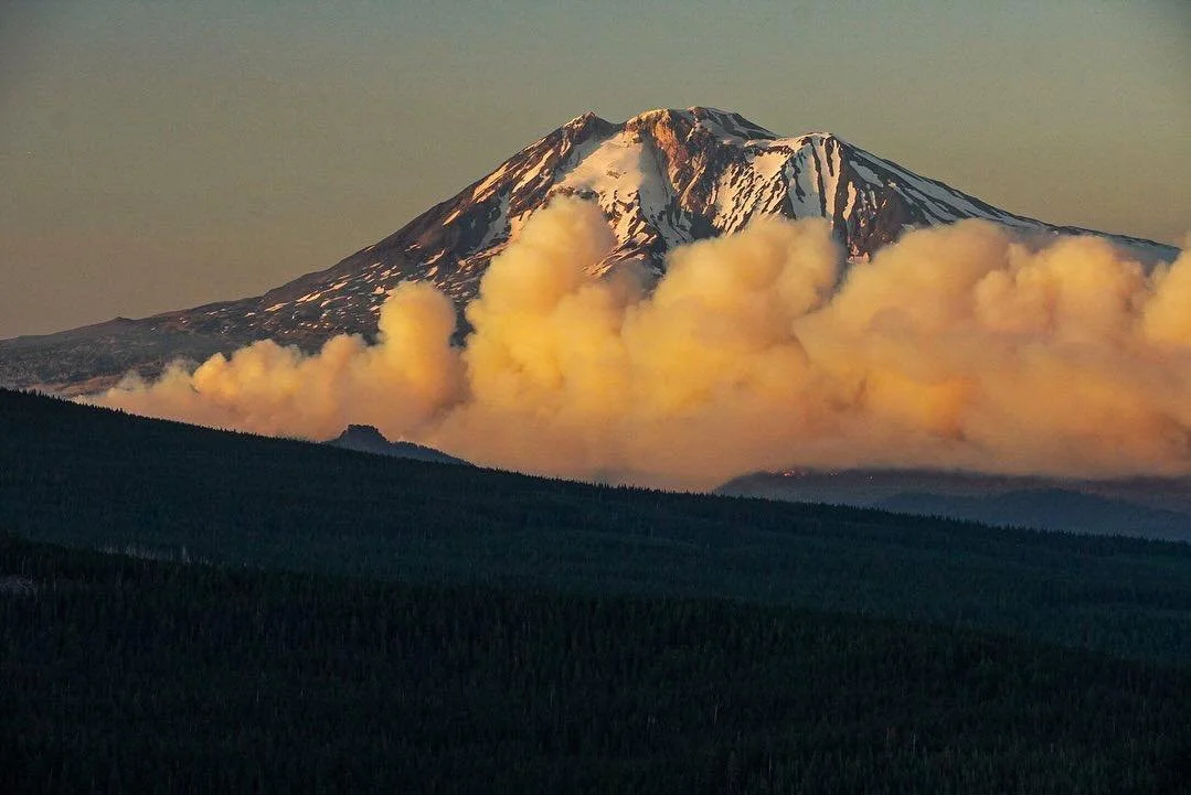
Photo courtesy the Williams Mine Fire / Ryan Ernst
By Tom Peterson
The Dalles, Ore., Aug. 15, 2024 — Fire managers continue to beef up crews and equipment as they battle the Williams Mine Fire burning 3.5 miles northwest of Trout Lake, Wash.
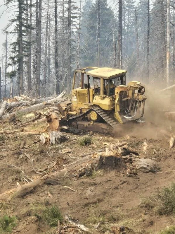
76 personnel were added in the last day, bringing the total count to 547 with 21 engines and 9 dozers to build containment lines.
The 11,000-acre fire burning in heavy timber is now estimated 2 percent contained.
The evacuation level in Trout Lake area was also dropped on Wednesday, Aug. 14 from a Level 3 GO NOW to a Level 2 BE SET. Former Level 2 evacuations are now at Level 1.
“Residents are encouraged to remain prepared to evacuate if conditions change,” the U.S. Forest Service said in today’s press release.
Evacuations are coordinated through the Klickitat County Sheriff’s Office and the Skamania County Sheriff’s Office.
“Today, an unmanned aerial system with infrared capabilities will assist firefighters by providing better mapping capabilities to enhance containment efforts,” the press release states.
“A slop over was detected where the fire had breached containment lines on the southern perimeter.”
A slop over is a fire edge that crosses a fireline or natural barrier intended to confine the fire.
“A dozer was routed to tie in line to the existing road to provide additional control options from the slop over. Dozer line was also completed around Snipes Mountain and tactical firing operations may be utilized to further secure perimeter security.
Today, crews continue to monitor the fire perimeter along the 020 road as masticators are prepping the 101 road for indirect containment opportunities. The structure group, including an engine from the Trout Lake Fire Department, completed assessments of structures on the southern end of the fire.”
COMMUNITY MEETING
A community meeting will be held today, Aug. 15, at 7:00 pm at the Trout Lake Volunteer Fire Department, 2415 WA-141, Trout Lake, WA 98650. This meeting will be recorded and posted to the Williams Mine Fire Facebook page for those unable to attend. The community will be provided a briefing by the Incident Management Team and Agency Administrators from local units on fire objectives and operations.
WEATHER / FIRE BEHAVIOR
There will be a chance for thunderstorms today, beginning in the late afternoon, primarily around the northeast side of Mount Adams. The atmosphere will be more unstable today than in previous days, with increased cloud cover, decreased temperatures, and the potential for plume development. The chance of thunderstorms is also forecasted for the weekend, with the potential for the area to also receive precipitation. The National Weather Service is predicting a high of 75 today in the Trout Lake area with winds ranging from 5 to 8 mph and gusts up to 20 mph.
SAFETY AND CLOSURES
Williams Mine Fire Map with evacuation levels, Aug. 15. Click on the map to enlarge it.
Scooper planes continue to dip out of Swift Reservoir and the Columbia River between Memaloose Island and Lyle, Washington. Members of the public and recreators should be aware that scooper planes could approach and dip out of these water sources at any time as weather conditions allow for aviation operations.
Washington DNR-managed lands near Trout Lake and Glenwood are closed to entry due to the Williams Mine fire. For more information, please see http://www.dnr.wa.gov/ahtanum. The Confederated Tribes and Bands of the Yakama Nation, Tract D Recreation Area is closed, please see Yakama Tract D Road Closure for more information.
Level 1 & 2 evacuations are in effect for the community of Trout Lake, and parts of Klickitat County. Evacuations are coordinated through the Klickitat County Sheriff’s Office and the Skamania County Sheriff’s Office.
The FS-23 and FS-25 roads are closed, see the Williams Mine Area and Road Closure for more details. The Pacific Crest Trail (PCT) is closed from the PCT's intersection with FS 23 to Potato Hill. The current area closure spans the entire Mt. Adams Wilderness.
Support Local News
Available to everyone. Funded by readers.