
Grasshopper Fire crosses control lines; crews build defenses north toward Dufur Mill
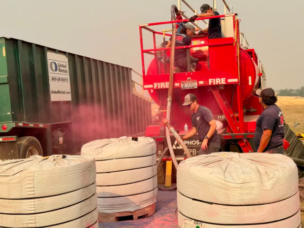
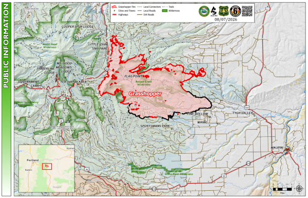
The Dalles, Ore., Aug. 7, 2026 — The Grasshopper Fire remained listed at 43,244 acres and 23% containment Friday, but hotter, drier conditions fueled new runs across control lines, forcing firefighters to expand contingency defenses north toward Dufur Mill while heavy smoke closed a portion of Highway 35.
The fire remains staffed by 1,405 personnel.
Fire Operations Section Chief Anthony Raposa said higher temperatures, stronger winds and lower relative humidity Thursday allowed the fire to make several significant moves around its perimeter.
On the southwest side, the fire crossed one of the primary bulldozer lines and was stopped in the Three Mile Creek area. Firefighters planned Friday to reinforce the road system and dozer line with aircraft dropping retardant. Heavy equipment, including masticators, feller bunchers and bulldozers, has already prepared a secondary line farther west, which has been outfitted with hose and pumping sites.
Farther north, fire that had been held along a ridge made a run northwest during Thursday's hotter and drier conditions and crossed Forest Road 2730, which firefighters had been using as a contingency line.
Crews were working Friday to catch that fire and tie it back into Forest Road 2730 while extending preparations north to Forest Road 21 and ultimately Dufur Mill. Firefighters were also beginning to assess Forest Road 21 for another contingency line, with Dufur Mill identified as a third defensive option farther north.
Elsewhere on the northern portion of the fire, crews picked up an estimated 50 to 75 spot fires along the Forest Road 10 area Thursday night. One larger slopover remained under assessment Friday morning, while firefighters worked to secure another section where flames reached a bulldozer line.
Despite those challenges, established containment lines across much of the southern and northeastern portions of the fire continue to hold. Crews continue mopping up around Badger Creek, Forest Road 27, Forest Road 20 and Flag Point.
Highway 35 remains a focus
Along the western edge, the fire continues slowly backing toward Highway 35. Crews are patrolling the corridor and watching for spot fires west of the highway.
Raposa said Friday morning that firefighters had not detected problematic spotting across Highway 35. Winds were helping push the fire back into previously burned areas, allowing it to slowly back toward the highway rather than make a rapid run across it.
However, heavy smoke and reduced visibility have affected travel. According to Friday's incident update, Highway 35 is closed between Bennett Pass Sno-Park and Baseline Road, and motorists are being directed to use alternate routes.
Fire managers are also looking beyond Highway 35. Contingency crews have begun assessing areas toward Timberline and identifying resources that could be needed if containment along the Highway 35 corridor becomes threatened.
Red Flag Warning Friday
A Red Flag Warning is in effect beginning Friday afternoon as hot, dry westerly winds move into the region. Those winds are expected to push heavy smoke east and could again increase fire activity.
Evacuation notices remain in place in portions of Wasco and Hood River counties, including Level 3 "Go Now" areas. Clackamas County also has Level 1 "Be Ready" evacuation notices associated with the fire.
The South Wasco County High School shelter in Maupin has closed, while the Sherman County Fairgrounds in Moro remains available as a large-animal shelter.
A Mt. Hood National Forest closure and Temporary Flight Restriction remain in effect around the fire. Forest Road 44 south of Forest Road 17 also remains closed.

Support Local News
Available for Everyone; Funded by Readers.
