
Larch Creek Fire Update: 7,100 acres; fire is human caused; Hwy. 197 closed
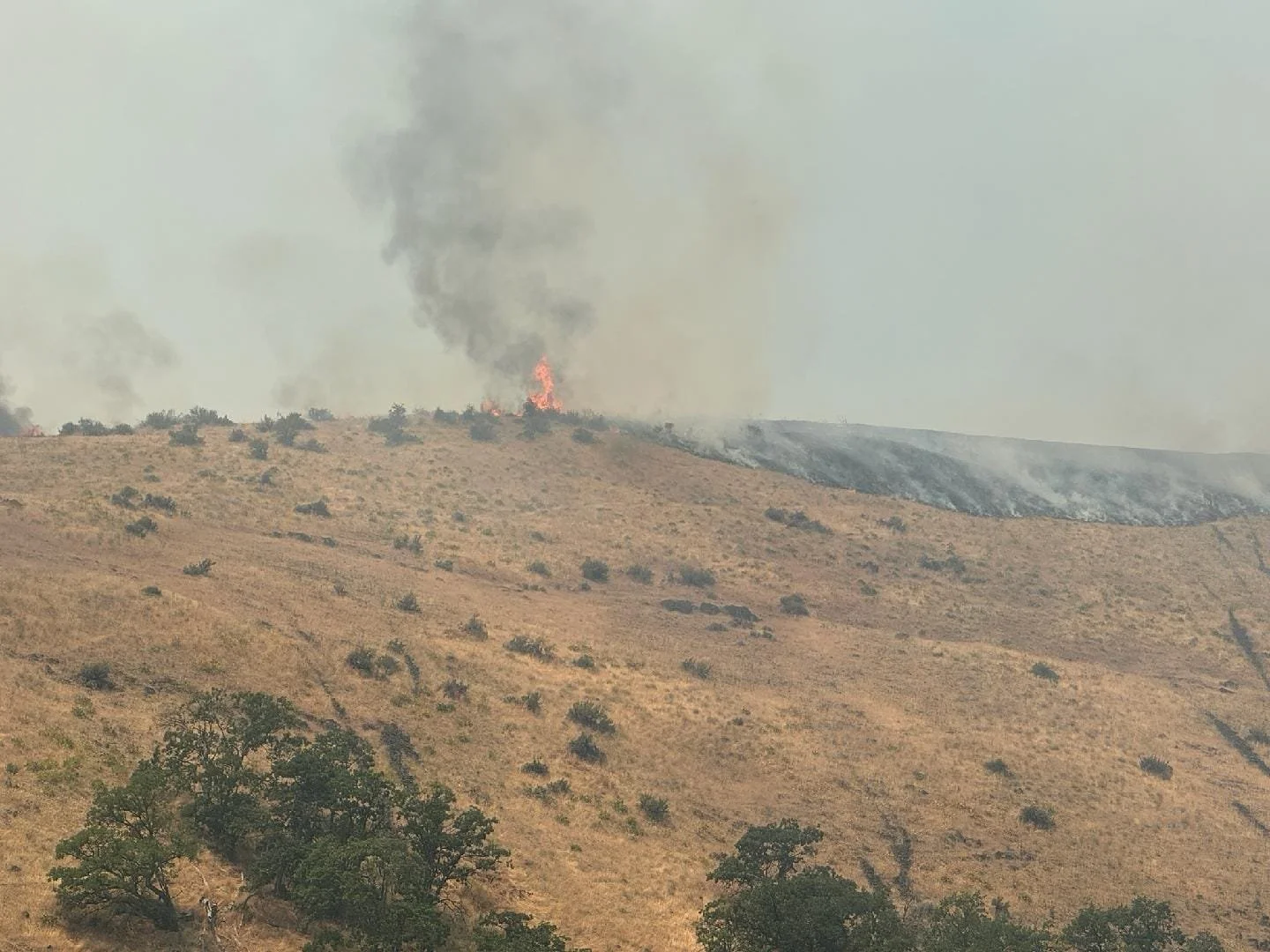
Photo courtesy of the Wasco County Sheriff’s Office
From the Oregon Department of Forestry and The Wasco County Sheriff’s Office:
Dufur, Ore. July 10, 6:30 p.m. — Initial attack crews worked through the night putting in dozer line and burnouts along the east and west flanks from the north down to the unsecured south.
No people have been harmed or structures lost, according to reports thus far.
The Oregon Department of Transportation closed U.S. 197 due to the wildfire between the junction with Shadybrook Road in Tygh Valley at milepost 33 to Dufur Gap at milepost 36. Closure points may change as fire activity shifts, Tripcheck.com will have the most updated information. More Info Here
A slight cooling trend and reduced winds on Thursday, July 11, could aid firefighters’ work to complete a fire line around the fire. Forecasters at the National Weather Service are calling for sunny skies, with a high near 91 on Thursday. Southwest wind is predicted to be 6 to 13 mph becoming north in the morning. Winds could gust as high as 18 mph. Gusts today, were estimated to hit 25 mph. Fires hit with heavy wind spread can blow embers outside the fire’s boundary creating additional spotfires. - Tom Peterson
Today, resources from state, local, and federal agencies will work on transitioning night shift crews to day shift while slowing progression towards Highway 197 and the nearby Shadybrook community to the south. Some spotfires have been identified in the southern Oak Creek area. Air attack remains a primary resource for day operations. The fire is burning mostly in open grass fuel types.
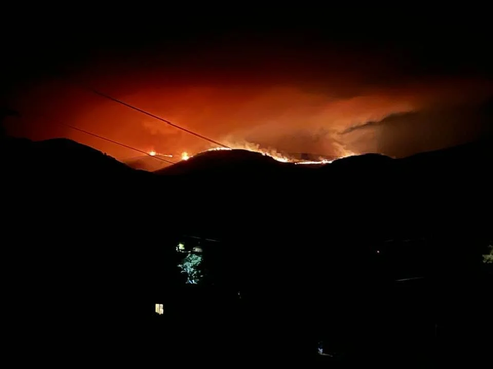
Photo by Mary Beechler - from Tygh Valley captured on Tuesday night, July 9. Posted on Columbia Gorge Wildland Fire and Information Page on Facebook.
The Emergency Conflagration Act was invoked Tuesday night around 8 p.m. by Governor Tina Kotek, which allows the State Fire Marshal to mobilize structural fire resources to protect life and property. Many arrived this morning, July 10, to assist with structure protection. Three task forces from Clackamas, Multnomah, and Washington Counties arrived at 7 a.m. and three additional task forces are arriving later this afternoon.
Unified Incident Commanders Cason McCain and Lance Lighty, among other officials gave gratitude to the crews on the initial attack, as well as local landowners who worked in extreme conditions to set the day shift crews up for success.
The Central Oregon Type 3 Interagency Fire Management Team as well as the Green Incident Management Team from the Oregon State Fire Marshal are in place at the Dufur High School.
Local fire danger levels are now set to “extreme” with expected wind. Stay informed on updated evacuation alerts here:
A Red Cross shelter is open at Maupin High School for anyone evacuated.
More information is on the official Larch Creek Fire Facebook page:
The Larch Creek Fire is located 5 miles southwest of Dufur, OR and was first reported July 9, just after 2 p.m. The cause was human activity and is under investigation.
FIRE AT A GLANCE
Estimated Size: 7,100 acres
Containment: 0%
Cause: Under investigation, human-caused
Evacuations:
Level 3 GO NOW – Remains in place for residences from Friend Rd, East to Elliott Rd and Hwy 197, South to Badger Creek Rd, West to Mc Corkle Grade Rd.
Level 2 GET SET - Remains from Fairgrounds Rd, East to Hwy 197, North to Shadybrook Rd, South to Fairgrounds Rd. Areas east of Hwy 197, east to the Deschutes River, north to Hulse Rd and south to Hwy 216
Level 1 GET READY - Remains from Badger Creek Rd/Fairgrounds Rd, South to Rock Creek Dam Rd/Wamic Market Rd, West to Threemile Rd, East to Hwy 197. **NEW AREA** Elliott Rd, East to Kingsley Rd./Dufur Gap Rd., North to Friend Rd. and South to Level 3 border.
Support Local News
Available to everyone. Funded by readers.