
UPDATE, July 20, 10 AM: Burdoin Fire Destroys Homes, Forces Lyle Evacuations as Blaze Grows to 8,500 Acres
Be Ready - green, Get Set- yellow and Go Now - Red Evacuations Map released on Saturday Night, July 19. Click on the image to enlarge it.
The Dalles, Ore., July 20, 2025 at 10 a.m. — The Burdoin Fire continued to burn unchecked Saturday night, destroying at least 14 homes, damaging dozens more, and forcing hundreds of Klickitat County residents to evacuate as winds pushed flames toward the community of Lyle.
By Saturday evening, the wildfire had grown to an estimated 8,700 acres with no containment reported, according to the Southeast Washington Interagency Incident Management Team. Firefighters worked through the night to protect homes, build fire lines and battle spot fires, particularly on the eastern edge of the blaze, where the fire jumped the Klickitat River and advanced on Lyle.
More than 250 structures remain threatened, officials said, with at least 37 primary structures damaged and 14 destroyed so far. Another 80 minor structures have also been damaged or lost.
The entire community of Lyle was placed under a Level 3 “Go Now” evacuation order Saturday afternoon, with residents ordered to leave immediately. Evacuation zones stretch across much of the Bingen-Lyle area, with Level 2 “Get Set” and Level 1 “Get Ready” notices extending eastward overnight as the fire behavior intensified.
On the late afternoon of Saturday July 19th, 2025 the Burdoin Fire jumped the Klickitat River at Oliver Point and headed East, North of Centerville Highway. This finger of the fire spread to Struck Road overnight. Fire teams are working hard to contain the fire but everyone within the Level 3 Evacuation Zone needs to evacuate to ensure your safety and emergency responder safety. All evacuations that the Klickitat County Sheriff’s office issued at 4:15pm remain in effect until further notice (see fire map below).
High Prairie Fire Chief Hancock says “If you are still in High Prairie, you should evacuate immediately! Fire crews need clear access to protect homes and fight the fire. The entire High Prairie area is at risk.” Do not delay - ‘Level 3 Go Now’.
The live interactive evacuation map can be found here (https://caltopo.com/m/0NL3FK3), the Klickitat County Emergency Management webpage (https://www.klickitatcounty.gov/249/Emergency-Management), and the Klickitat County 911 Dispatch FaceBook page.
There are two Red Cross Emergency Shelters available. On the West Side the shelter is located at Columbia High School, C Court Building, off of NW Simmons Road in White Salmon. On the East Side the shelter is located at The Dalles Middle School in The Dalles, Oregon on East 12th Street.
For livestock and animal evacuation, shelter assistance, and general questions contact Klickitat County Emergency Operations Center at 509-773-0570.
Mayor Marla Keethler of White Salmon said in a Saturday morning statement that about 250 firefighters are expected to be on the ground by the end of the day, with an incident command post now operating at Henkel Middle School.
“Crews remain actively engaged, working day and night to keep us safe,” Keethler said. “We extend our deepest gratitude to the firefighters and all those supporting this response.”
Highway 14 remains closed from mile marker 66 near Bingen to mile marker 76 near Lyle. Other closures include Highway 142 from Highway 14 north to mile post 5, and Centerville Highway from Highway 14 to Centerville.
Fire officials said wind gusts up to 25 mph are expected Sunday, complicating firefighting efforts. Residents of the Strawberry Mountain Pressure Zone were also asked to conserve water to help supply the command center and shelter operations.
One firefighter has been injured and transported for medical care.
The cause of the fire remains undetermined. Residents can find the latest evacuation maps and shelter information on Klickitat County Emergency Management’s website and Facebook page.
Saturday, July 19, 7 p.m. Update
From Liam Winstead & Jaimee Whitfield by • Watch Duty Staff Reporter
UPDATE: Jul 19 at 6:54 PM
The fire is 6,421.5 acres per the perimeter uploaded to the National Interagency Fire Center (NIFC)
UPDATE: 3.19 PM July 19th
New Level 1, 2, & 3 Evacuations to the North and East - A new map has been released per Klickitat County Emergency Management's interactive evacuation map.(see image above, released 3.20pm July 19th 2025)
Reference the linked map here or a screenshot of the evacuation map above for parameters.

—
From Watch Duty by Jaimee Whitfield Jul 19 at 2:30 PM
The fire is 3,266.6 acres per the perimeter uploaded to the National Interagency Fire Center (NIFC), which is visible on the Watch Duty map under the Active Fire Perimeters map layer.
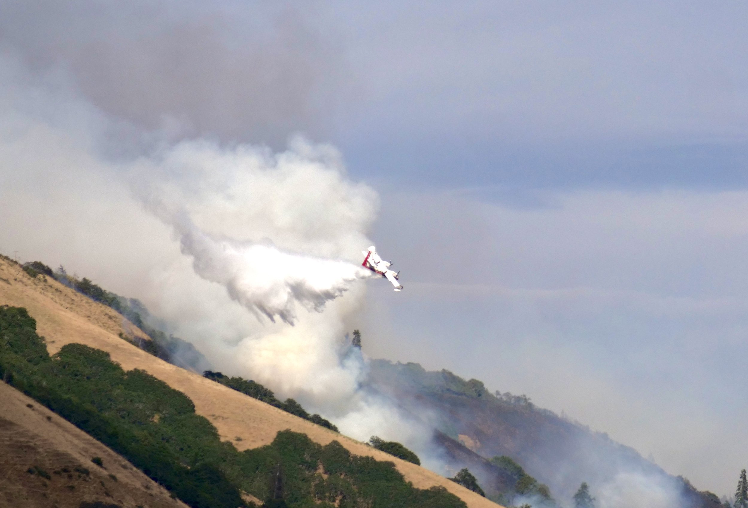
Aircraft tackle Burdoin Fire in Bingen Wa, July 2025
—-
Jaimee Whitfield From Watch Duty, Jul 19 at 12:33 PM
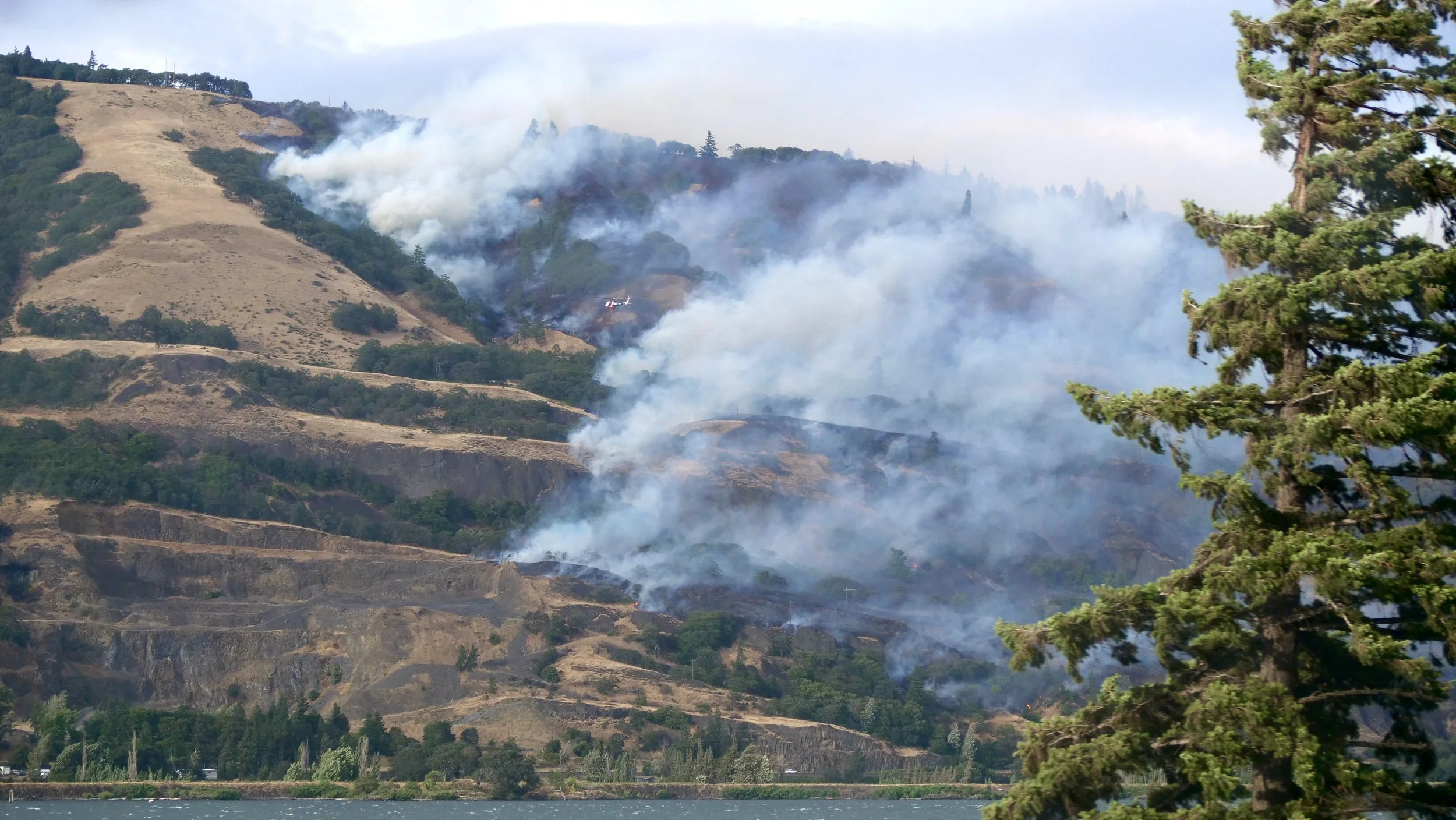
July 19, 2025 Update: The Southeast Washington Incident Management team took command of the Burdoin Fire at 6:30 AM Saturday, July 19, 2025. Washington State Fire Mobilization was approved Friday, July 18th at 5:30 PM. The fire is supported by Washington State DNR, Washington State Fire Mobilization, West Klickitat Regional Fire Authority, Klickitat County Fire District 4 - Lyle, and US Forest Service, Columbia River Gorge National Scenic Area. The fire grew rapidly on Friday and continued to move to the east and northeast overnight. Today crews will be assessing for damaged structures in the fire area.
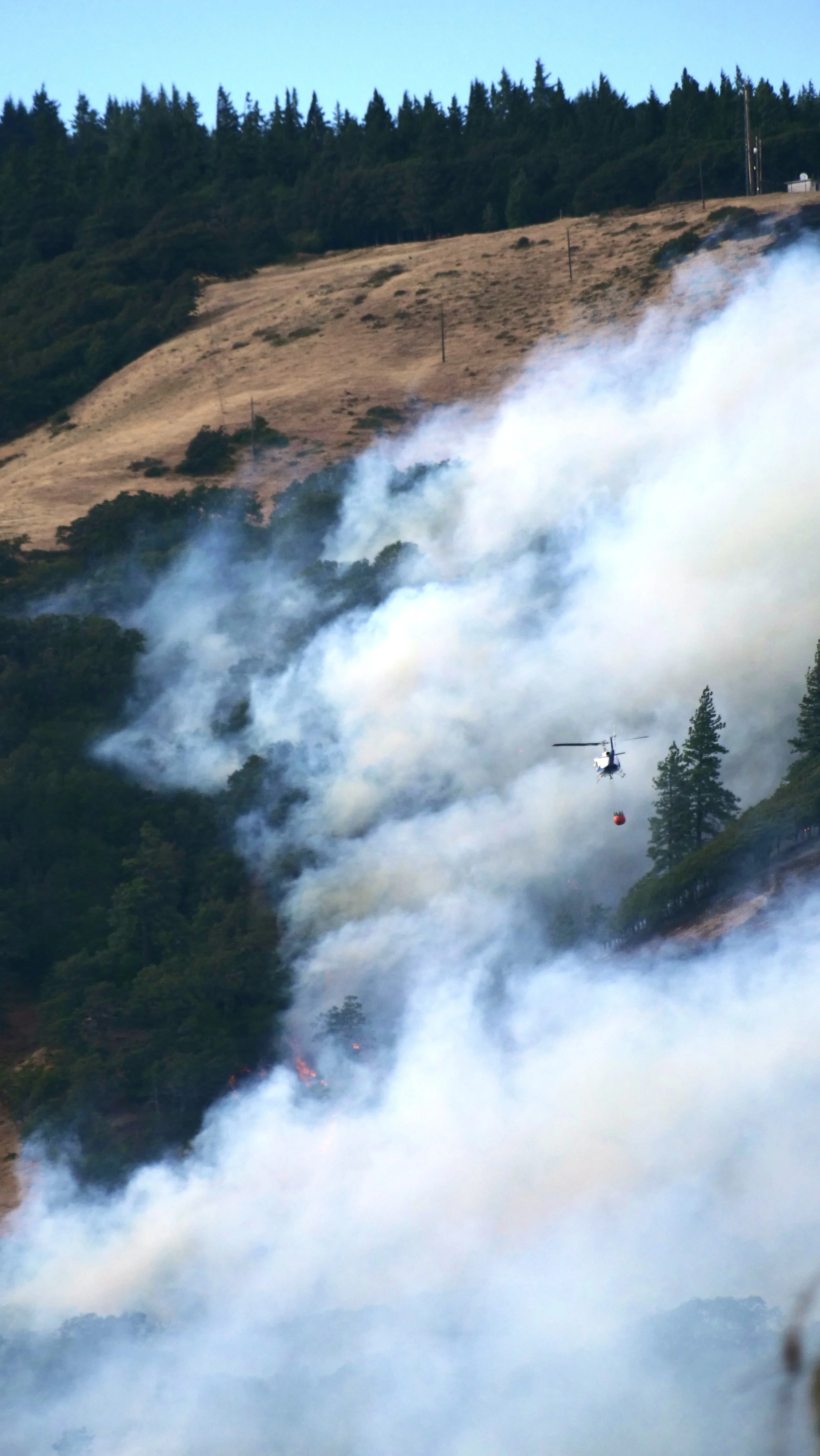
The fire is burning on both sides of Highway 14. Multiple structures are threatened by the fire. Structural protection and fighting the fire are high priorities as new resources arrive on the incident today. Aircraft will be actively operating in that area working to help control the fire spread and support ground resources. Ground crews will be working to secure the fire, anchoring to roadways and trails as available. Firefighting aircraft and crews are pulling water from the river, so Columbia River users should be alert to fire activity and resources in the area.
A fire train is working along the railroad tracks, extinguishing the fire along the rail line that runs parallel to the Columbia River. Due to rocks, trees and debris rolling down onto Highway 14, the highway has been closed from mile marker 66, east of Bingen to mile marker 76, west of Lyle. Travelers should find alternate routes or follow the detour around that area.
Weather and Fire Behavior: Today will be mostly sunny with highs around 80. Breezy west winds are expected to continue, 10-17 mph, through the weekend with stronger winds anticipated higher up the ridges, 12-20 mph. Tonight the winds will continue, and it will be partly cloudy with temps in the low 60s.
Smoke: Air quality is good in most areas around the fire, but Lyle is being reported as unhealthy due to smoke in that area. For sensitive groups, consider closing windows and doors and consider indoor activities. For more information on smoke and air quality, visit Washington Smoke Information (https://wasmoke.blogspot.com/).
Air Space Restrictions: There is a Temporary Flight Restriction (TFR) in place over the fire. Any unaccounted-for aircraft, including drones, puts aerial firefighting resources and lives at risk. If you fly, we can't. All firefighting aircraft must be grounded if unmanned aircraft or drones are operating near the fire.
Resources: Seven strike teams. Five hand crews. Fire support will be at approximately 250 people as more crews arrive Saturday.
—
From Columbia Gorge Wildland & Fire Information Page:
The Dalles, Ore., July 18, 2025 at 8 p.m. — A fast moving wildfire burning east of Bingen, Wash. is now estimated at 1,500 to 2,000 acres and is listed with a '“HIGH” potential for growth. It prompted a “GO NOW” evacuation notice for South Highway 14 near Mile Post 68, North to Forbes, East to Courtney Rd.
In addition the Level 2 -Get Set notice has been expanded East- CHECK map below - South at Forbes Rd to North at Bates Rd, West at Tunnel Rd. East at end of Bristol Rd.
Level 1 - Get Ready - Evacuations have expanded East South at Bated Rd to North at Billette Rd, West at Sandborn Rd and East at Acne/Crystal Rd
Hwy 14 West bound is closed at mile post 68, according to the Facebook Page.
The fire was spotted across Courtney Road around 3 p.m. making it impassable, with power lines burning.
Wind is blowing west northwest at 13 mph as the fire is falling on a red flag warning day as the forecast calls for sustained winds at 18 with gusts up to 30 mph tonight.

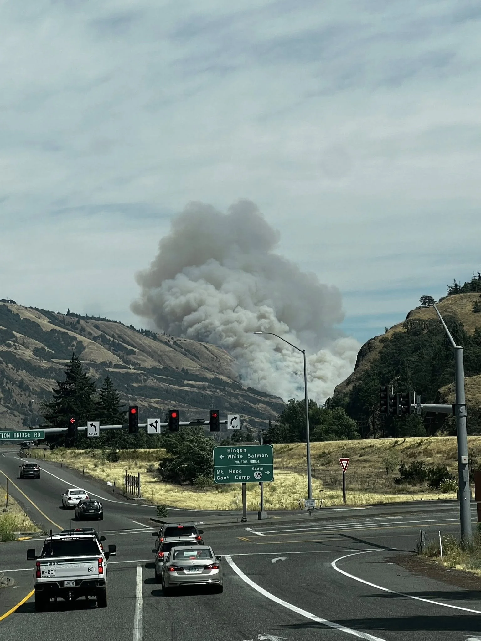
Budoin fire from I-84 3am July 19th 2025
While the temperature currently stands at 82 degrees Fahrenheit, it is expected to drop to 54 tonight, according to the National Weather Service.
For additional information and latest updates on evacuation click here.


Tonia Farman posted this photo of the fire east of Bingen around 3 p.m.