
Warmer temps spur burn inside containment lines of Williams Mine Fire
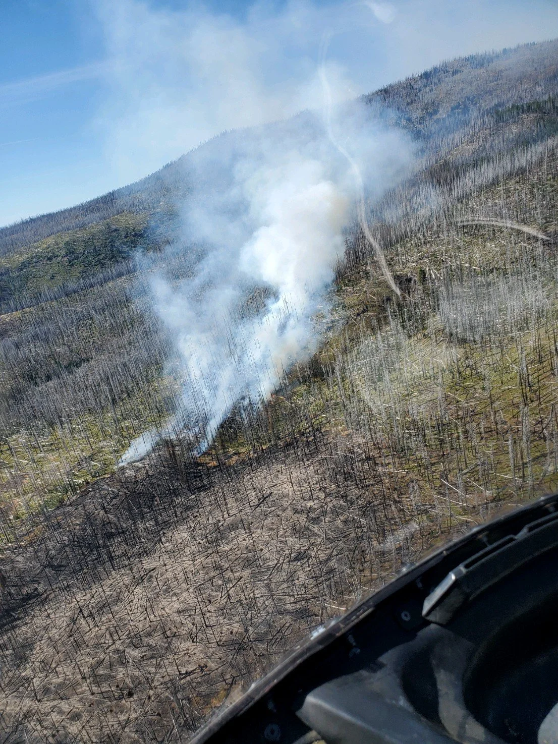
The smoke seen from town today, has been assessed from the air. It has been deemed a non threat, to our fire line. Photo Courtesy Williams Mine Fire page.
By Tom Peterson
The Dalles, Ore., Aug. 30, 2024 — Warmer temperatures increased burning in the Williams Mine Fire near Trout Lake, Wash., however the increased activity is not threatening containment lines, according to the latest report from the U.S. Forest Service.
An aerial reconnaissance flight found the area creating the most smoke is on the north side of the fire, in the wilderness area between Morrison and Shorthorn creeks. Fire personnel plan to wap the Morrison Shelter and do work near the South Climb trailhead in case the fire moves toward them.
Warmer temperatures in the mid-90s this weekend will likely intensify the burn. Uncontained edges of the burn in the wilderness as well as pockets of residual fuels in the interior of the fire will continue to burn and produce smoke, the press release stated. A Blackhawk helicopter is available to drop water if needed to cool flare-ups.
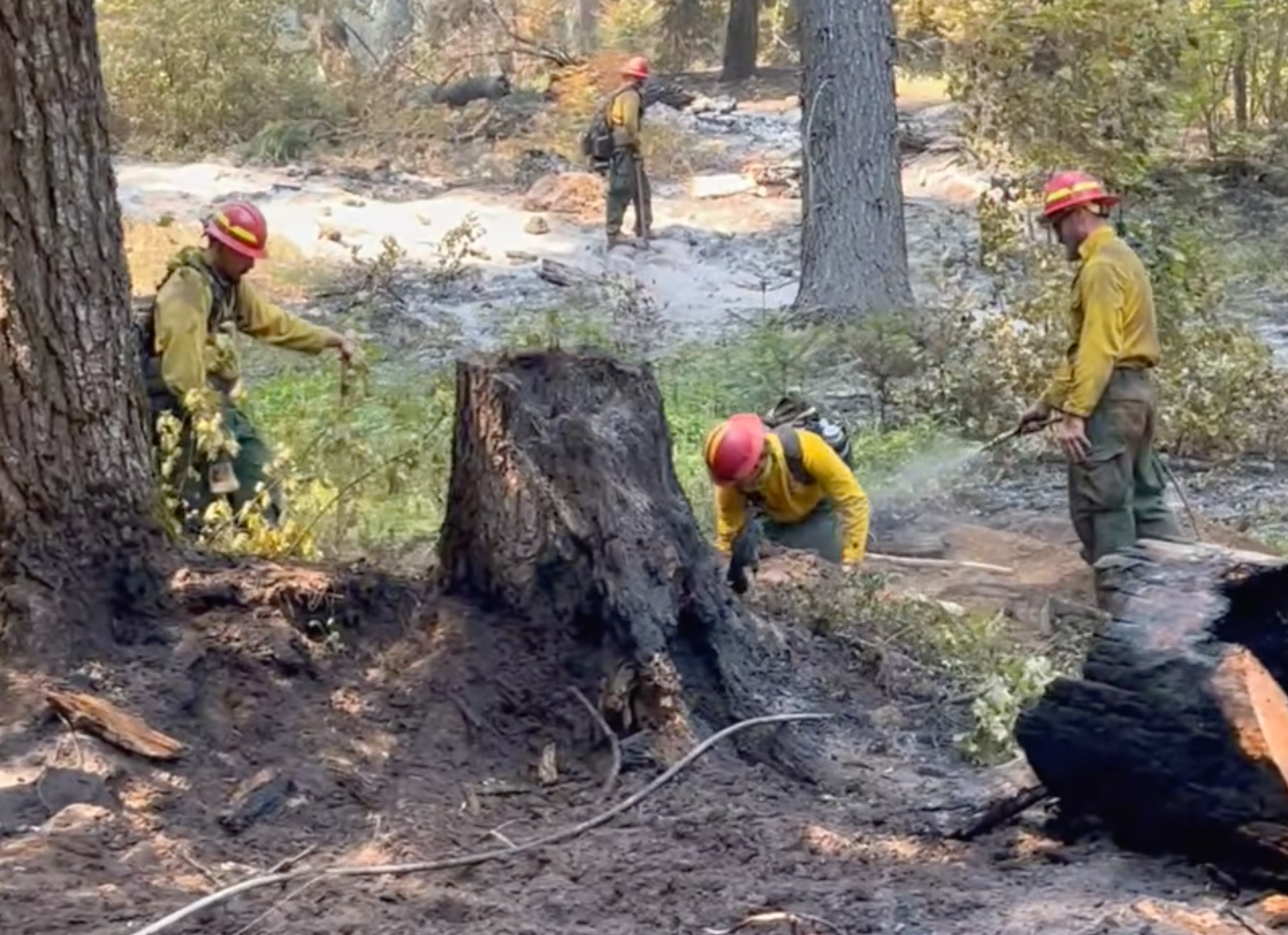
Work on the shaded fuel break continues along the FS Rd 23 south of the FS Rd 23/FS Rd 90 junction. Equipment is being used to remove the smaller trees and brush, leaving larger, well-spaced, fire-resistant trees to grow.
Removal of the smaller vegetation reduces the fuels that can support a fire moving through this strip and the chance of fire climbing into or through the crowns of the remaining trees. This makes any fire that hits this fuel break likely to be on the ground burning at a low intensity, giving fire personnel a chance to stop a running fire.
Williams Mine Fire Map. Click the image to enlarge it.
SAFETY AND CLOSURES
As we head into the Labor Day weekend, please remember that campfires, fireworks, and other potential sources of wildfire ignitions are banned on USFS lands and other forested lands, even in approved campsites. Fire personnel have been working hard this year controlling lightning-caused wildfires. Please be careful and don't start additional fires.
The Trout Lake Community Rummage Sale is this weekend, 8/30 to 9/2/24. Expect heavy traffic on the roads and watch for pedestrians.
The Confederated Tribes and Bands of the Yakama Nation, Tract D Recreation Area is currently closed, please see Yakama Tract D Road Closure for more information. FS Rd 23 south of FS Rd 90 is still CLOSED to the public due to fire suppression activity. The revised closure for the Mt. Adams Wilderness and FS Rd 23 closure can be found at Williams Mine Fire: Area and Road Closure. The Pacific Crest Trail (PCT) is closed from the PCT's intersection with FS Rd 23 to Potato Hill.