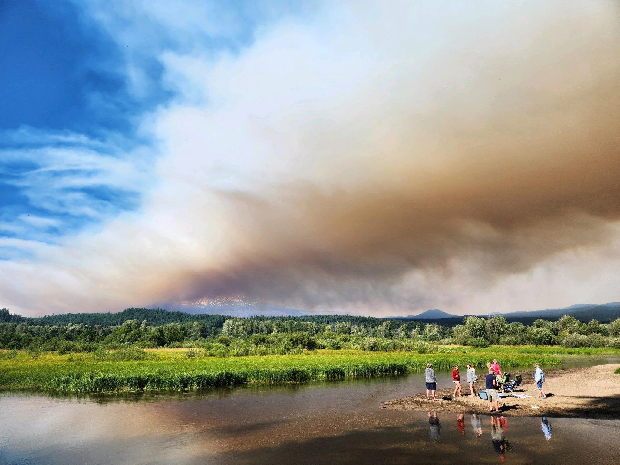
Williams Mine Fire at more than 5,500 acres; more crews, equipment ordered
Photo courtesy the Williams Mine Fire page.
By Tom Peterson
The Dalles, Ore., Aug. 9, 2024 — The Williams Mine Fire burning near Trout Lake, Wash., continued to grow another 1,000 acres as fire maps now show estimates of some 5,500 acres in the burn area.
The fire is estimated to be 1% contained.
96 personnel are fighting the lightning-caused blazed that torched off on Monday, Aug. 5 in the Mt. Adam’s Ranger District.
“Yesterday, firefighters and assigned equipment continued suppression efforts on the fire, working along the 8020 Road and the 8031 Road towards the 23 Road corridor, according to a press release from the U.S. Forest Service. “Ground and aviation resources worked to suppress spot fires. Resources also worked on constructing contingency lines on the north-northwest side of the fire perimeter. The structure protection group worked in the southern portion of the fire to identify critical infrastructure and assess structures.”
“Today, Aug. 9, firefighters have been assigned equipment will continue to strengthen containment lines by clearing brush and other vegetation along the fire perimeter. Suppression resources, including aviation resources, will continue to work spot fires. Hot shot crews, hand crews and other equipment have been ordered for the fire. When they arrive, they will be assigned to help with the containment effort. Structure protection resources will continue to map infrastructure and conduct property assessments in the fire area. The fire continues to actively burn in heavy timber,” the press release states.
The fire perimeter is approximately 3.5 miles away from the closest point of the Yakima Nation Reservation.
Continued hot weather with highs predicted in the low 90s in the Trout Lake region are expected today with winds predicted at 5-7 mph in low lying areas and 10 mph wind on ridgelines. Winds are blowing out of the east-northeast with humidity between 19-24 percent.
Evacuations
Williams Mine Fire Map for Aug. 9. Click on the image to enlarge it.
Level 2 & 3 evacuations are in effect for the community of Trout Lake. An evacuation center is located at 1455 NW Bruin County Road, White Salmon. Evacuations are coordinated through the Klickitat and Skamania County Sheriff's Offices.
Real-time updates and information about evacuations can be viewed on their websites and Facebook pages:
Closures
A Forest closure is in effect for the entire Mt Adams wilderness and areas adjacent to the fire. See full closure order information at: Gifford Pinchot National Forest - Alerts & Closures (usda.gov) .
The Pacific Crest Trail is closed between Willaims Mine and Potato Hill. Additional information is found on the Pacific Crest Trail Association website. The public is asked to avoid closure areas for their safety and the safety of the firefighters. William's Mine Fire | Pacific Crest Trail Closures (pcta.org)
The 23 and 25 roads are closed; thus, there is no good north-south route through the national forest in the area.
Fire Restrictions
Public Use Restrictions for fire are in place on the Gifford Pinchot National Forest. Building, maintaining, attending, or using a fire, campfire or charcoal fire is prohibited outside of designated developed campgrounds. For additional fire information, please visit the Gifford Pinchot National Forest website at Gifford Pinchot National Forest - Fire Management (usda.gov)
Cooperating Agencies & Tribes: Klickitat County Sheriff’s Department, Skamania County Sheriff’s Department, Washington Department of Natural Resources, Pacific Crest Trail Association, Bureau of Indian Affairs-Yakama Nation, Klickitat County, and Skamania County.

