
Williams Mine Fire near Trout Lake over 3,000 acres; shelter at Columbia High School
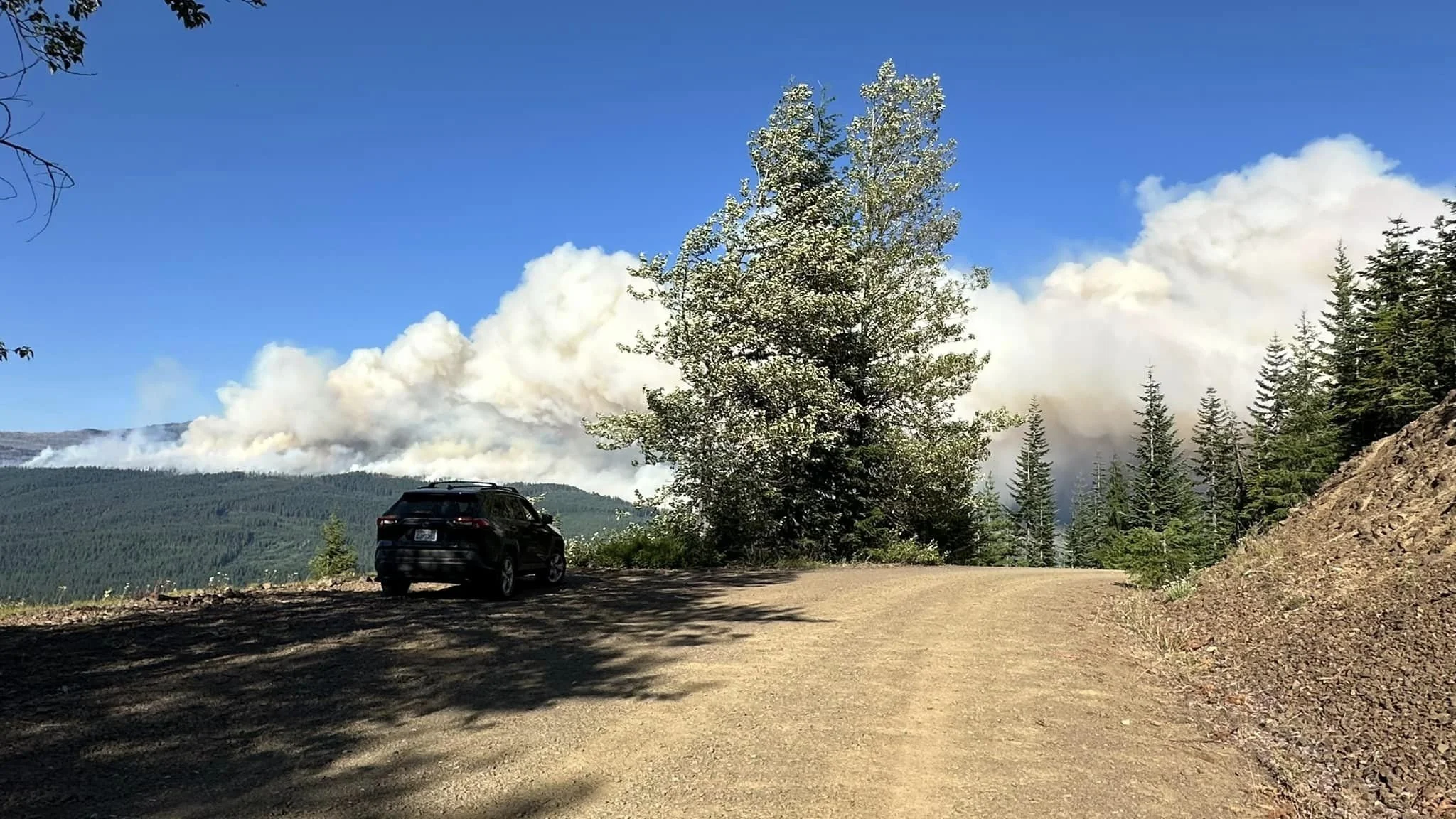
Photo courtesy the Mt. Adams Area and Emergency Info Page on Facebook.
By Tom Peterson
The Dalles, Ore., Aug. 7, 2024, Noon — More than 3,000 acres are estimated burned in the Williams Mine Fire burning near Trout Lake in the Mt. Adams Ranger District and Go Now evacuations were ordered Tuesday night for people living in the vicinity, according to the Mt. Adams Area and Emergency Info Page on Facebook.
Evacuations were called out at 11:55 p.m. for:
North of Sunnyside Road and east of Mt. Adams Rec Road near Trout Lake is now on Level 3 Go Now Evacuation Notice. The town of Trout Lake is on Level 2.
A Red Cross shelter for people evacuating has been set up at the Columbia High School in White Salmon at 1455 NW Bruin County Road. Pets are welcome, they ask that bring your own crates and food for them. However, if you do not have those items, they will do their best to help you find them
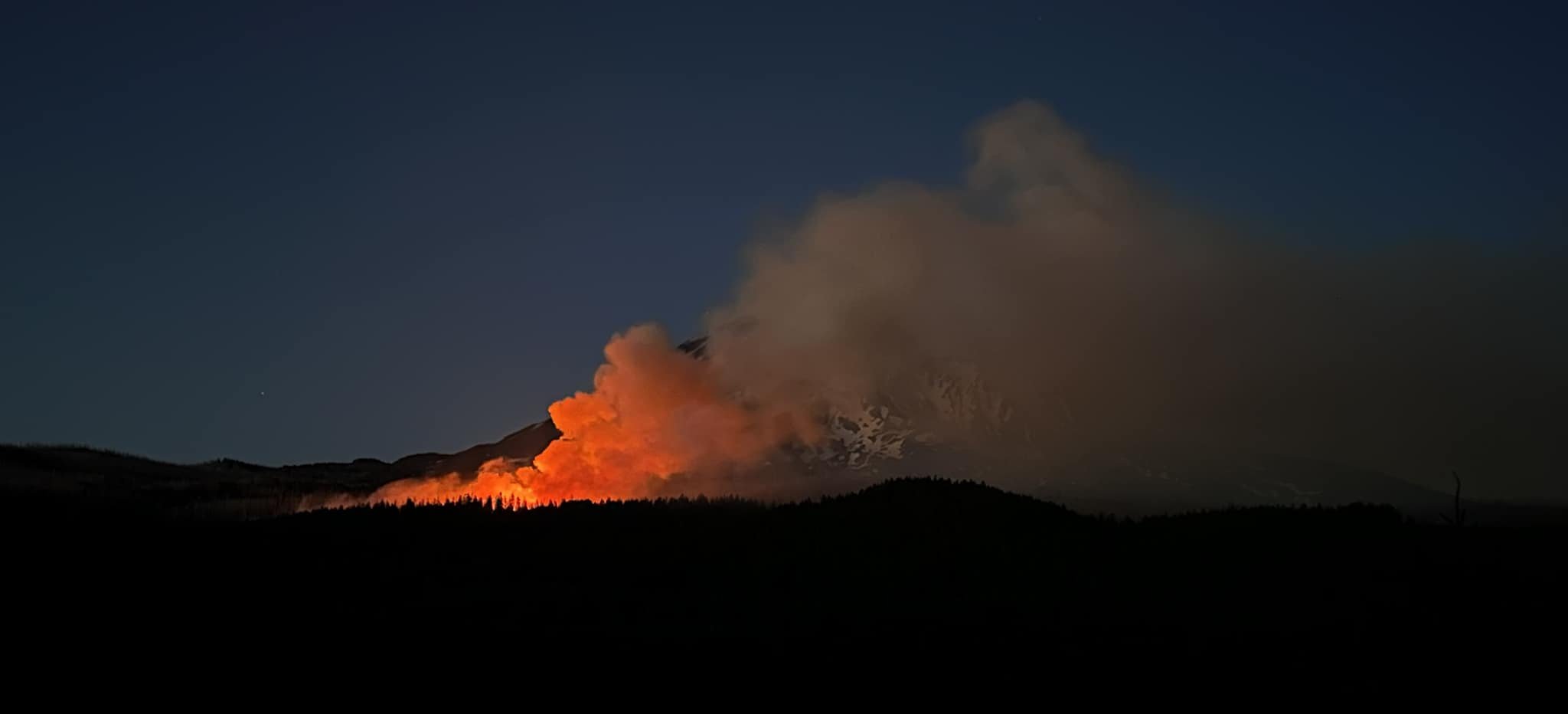
Photo courtesy the Mt. Adams Area and Emergency Info Page on Facebook.
A type 3 fire management team is being assembled and expects to be operational on Thursday, providing additional information about the lightning-caused fire that started on Monday, according to the Mt. Adams Ranger District Office.
The National Weather Service is predicting a high of 92 degrees today in Trout Lake, adding to dry conditions in the area. However, light wind is predicted, limiting the chance of spot fires.
All evacuations are coordinated through the Klickitat and Skamania County Sherrif’s Offices. Stay informed as evacuations levels may change rapidly.
For updates and evacuation information:
Klickitat County Emergency Management: https://www.klickitatcounty.org/249/Emergency-Management...
Facebook: Klickitat County 911 Dispatch / Emergency Management
Skamania County Emergency Management: https://www.skamaniacounty.org/.../emergenc.../-fsiteid-1...
Facebook: Skamania County Emergency Management
Closed areas:
- The Mt. Adams Wilderness Area
- Forest service Road 23
- South Climb trailhead.
- Pacific Crest Trail between Williams Mine and Potato Hill.
Williams Mine Fire Locator map. Click the image to enlarge it.
“The fire is burning SW of Mount Adams, started by lightning near the source of the White Salmon River. It crossed the Pacific Crest Trail in that area. It is moving south southeast affecting Skamania County and a small portion of Yakima County. It could potentially move soon into Klickitat County, the information page stated.
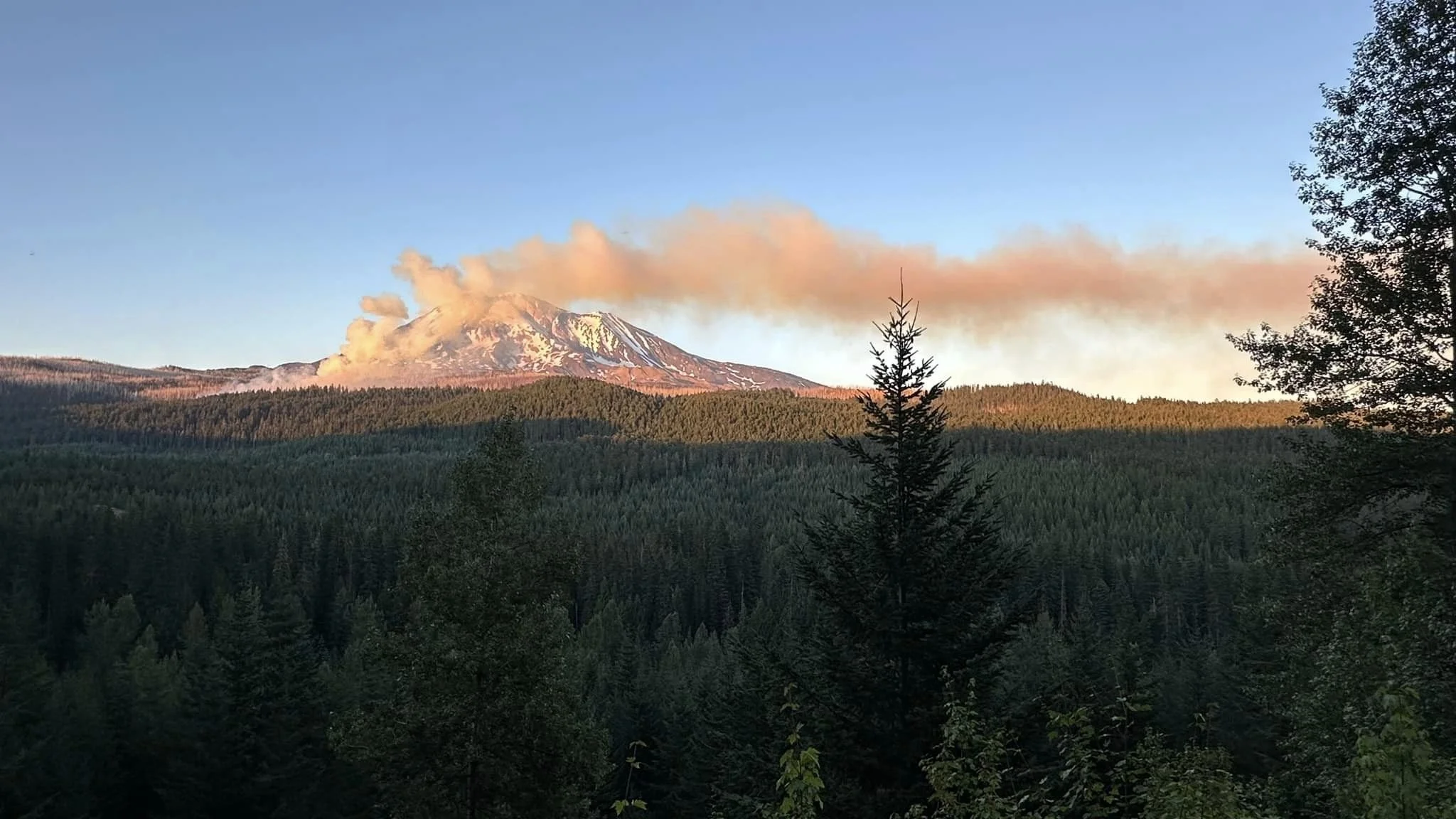
Photo courtesy the Mt. Adams Area and Emergency Info Page on Facebook.
On Tuesday, Aug. 6, the fire blew up in the afternoon and traveled a few miles, according to the Mt. Adams page. A portion of Trout Lake east of Mount Adams Highway and north of North Sunnyside Road was put under level three evacuation. The fire sent embers ahead and created spot fires moving to the southwest from the main fire. Winds subsided by midnight, allowing firefighters to gain control of the spot fire in the area of Mount Adams horse camp at around 1 a.m.

Support Local News
Available to everyone. Funded by readers.