
Cottonwood Fire fuels rapid growth of Hay Creek Complex, now nearing 156,000 acres in Gilliam County
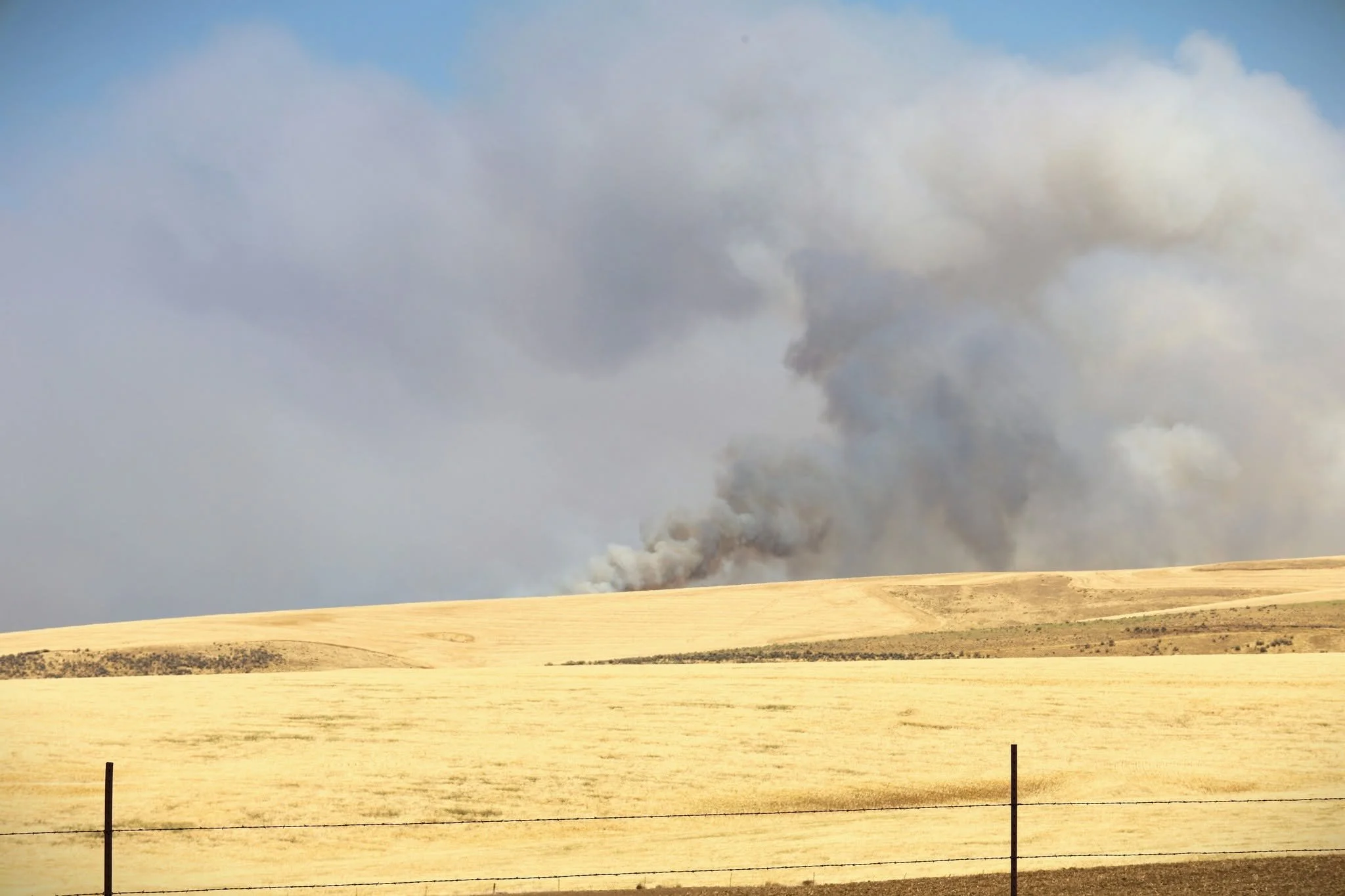
From Gilliam County Sheriff's Office, Hay Creek Complex 2026 with edits from Tom Peterson
The Dalles, Ore., July 24, 2026 — The Cottonwood Fire rapidly expanded Thursday after igniting in Esau Canyon east of Cottonwood Canyon State Park on the John Day River, burning thousands of acres of rangeland and wheat fields as firefighters continued battling the Hay Creek Complex across Gilliam County.
Fire officials estimated the Cottonwood Fire had grown to more than 8,000 acres by Thursday evening after being reported Wednesday night by a local resident following a lightning storm. The fire is burning southeast of the John Day River near Devil's Butte Road, where gusty winds and hot temperatures fueled aggressive fire behavior throughout the day.
The Cottonwood Fire also merged with the nearby Hoag Fire, stopping the Cottonwood Fire's northeast progression, according to fire officials.
With the rapid growth of the Cottonwood Fire, The Hay Creek Complex has now grown to 155,798 acres, making it one of Oregon's largest active wildfire incidents. The complex includes the 79,704-acre Porcupine Ridge Fire, the 50,224-acre Hoag Fire, the 11,366-acre Hopkin Fire and the rapidly expanding Cottonwood Fire, which reached 14,504 acres Friday. Nearly 950 firefighters, supported by 28 hand crews, 53 engines and 13 bulldozers, are assigned to the complex as crews continue battling hot, dry and windy conditions across Gilliam County.
Click to enlarge fire map. Courtesy Hay Creek Complex 2026
The latest fire comes just one week after lightning ignited multiple fires across Gilliam County, including the Starvation Point Fire, which threatened to spread into Esau Canyon before firefighters and local landowners halted its advance through overnight dozer line construction and strategic burnout operations. Although that effort protected the canyon at the time, the new Cottonwood Fire has since burned through the same area, destroying hundreds of acres of unharvested wheat.
Fire managers said aerial resources worked throughout Thursday to slow the fire's spread while ground crews established and strengthened containment lines. Winds are expected to remain elevated Friday with gusts approaching 30 mph, creating continued challenges for firefighters.
The Gilliam County Sheriff's Office expanded evacuation warnings Thursday afternoon, issuing a Level 2 "Be Set" evacuation notice for residences along Hay Canyon Road, Mikkalo Lane, Highway 19, French Charlie Road, Scott Canyon Lane, Pennington Road and Clem Road. Residents were urged to prepare for immediate evacuation by gathering medications, important documents, livestock and pet supplies, and other essential belongings.
Earlier Thursday afternoon, the sheriff's office reported the fire at approximately 3,000 acres before updated estimates placed it at more than 8,000 acres by evening.
The Cottonwood Fire is one of several lightning-caused fires burning within the Hay Creek Complex, which has drawn firefighting resources from local, state, federal and private agencies across Oregon. Crews from departments throughout the Columbia Gorge, eastern Oregon and the Portland metropolitan area continue working alongside ranchers, farmers and heavy equipment operators to protect homes, crops and critical infrastructure.
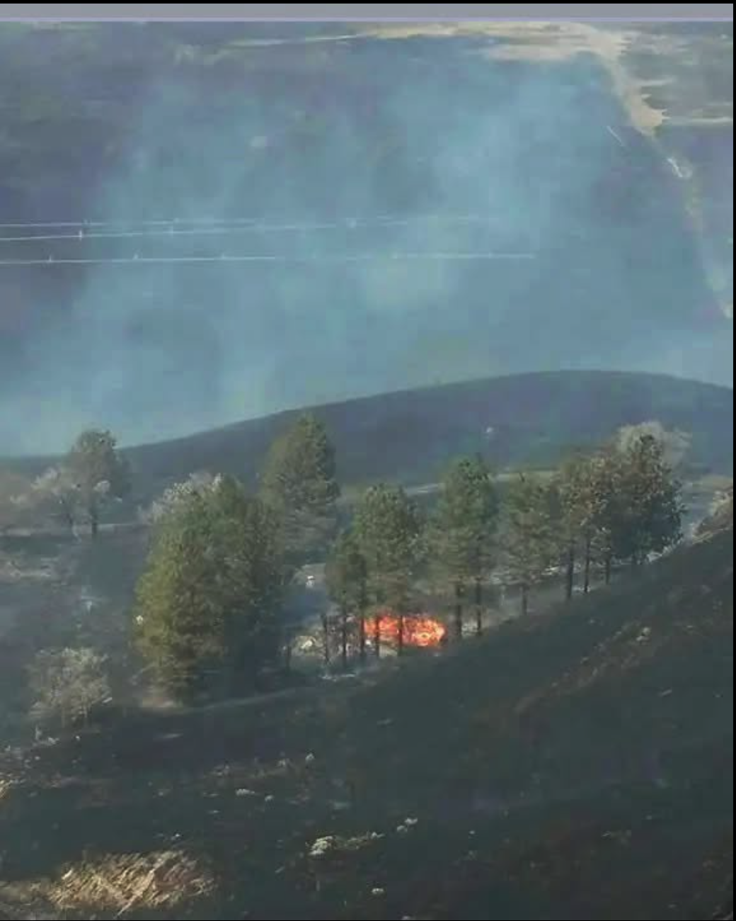
Photo courtesy Jane Kirkpatrick Facebook Page
The fires have also taken a personal toll on area residents. Oregon author Jane Kirkpatrick, whose novel Homestead was inspired by her family's property along Starvation Lane near the John Day River, said the family's homestead, house and barn were destroyed in the July 16 wildfire.
"Only the stories and a few trees we planted are left. And the memories that cannot burn," Kirkpatrick wrote in a social media post, adding that she was grateful her late husband was not alive to witness the loss.
Fire officials continue asking the public to avoid the Devil's Butte Road area and any active fire zones so engines, aircraft and heavy equipment can operate safely. Current evacuation information remains available through Gilliam County's interactive evacuation map.