
Firefighters battle weather & fire near White Salmon as new fires ignite near Brewer Road and Bickleton

Air drops to quell flames in the Burdoin Fire.
The Dalles, Ore., July 23, 2025 — As the Burdoin Fire burns into its sixth day, firefighters are racing against rising temperatures and wind to contain the estimated 11,000-acre blaze threatening homes, infrastructure, and public lands in the Columbia River Gorge.
The fire, located about 2.5 miles east of White Salmon, remains just 5% contained, and officials say it may take weeks to fully extinguish lingering hotspots in the region’s steep, timbered canyons. A total of 870 personnel, supported by five aircraft and more than 100 engines, are currently assigned to the fire.
New fires are also complicating efforts to protect people and structures.
The Brewer Road Fire ignited today near a logging operation about 3.5 miles up Brewer Road (north of Klickitat). It’s believed to have started around 1:35 p.m., triggering swift Level 3 “Go Now” evacuations for Klickitat, Wahkiacus, Skookum Flats, Long Road, and surrounding areas.
Meanwhile, the Bickleton (Oak Flat) Fire broke out along Bickleton Highway this afternoon, with crews spotting it around 4:00 p.m. near the intersection of Bickleton Highway and Old Mountain Road. Initial estimates put its size at 20–30 acres before containment efforts began . Click here to read more about Brewer Road and Bikleton fires.
Winds are forecasted by the National Weather Service to remain steady in the area of the fires. They are predicted to be out of the west through the weekend, ranging from 5 to 13 mph and gusting up to 25 mph on Thursday and Friday. Highs will reach 83°F Thursday, 78°F Friday and Saturday, and 80°F on Sunday. Winds are expected to ease slightly by the weekend.
Crews have been strategically starting fires to close off unburned pockets of fuel and reinforce containment lines, particularly around the Catherine Creek drainage and east of the Klickitat River. On the ground, structure protection teams are focused on extinguishing flareups and expanding defensible space around homes from 100 to 200 feet.
"Evacuations will remain in place until these areas are safe," according to the Klickitat County Sheriff’s Office. Officials continue to assess hazards near structures and utility infrastructure.
The fire began on July 18 and its cause remains under investigation.
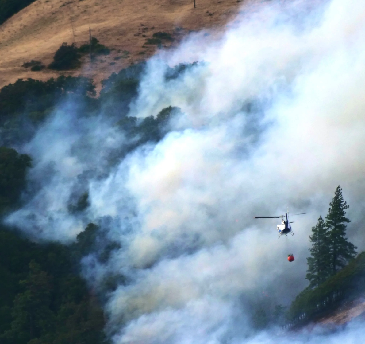
Helicopter carrying water to tump on the advancing flames on the Burdoin Fire.
High Winds and Road Closures Complicate Suppression
A forecast this morning, July 23, of above-average temperatures and sustained winds up to 20 mph, with gusts reaching 35 mph, poses new challenges for fire behavior and suppression efforts.
Major transportation corridors remain closed, including:
Highway 14 from mile marker 66 (east of Bingen) to mile marker 76 (west of Lyle)
Highway 142 from Highway 14 north to mile 5
Centerville Highway from Highway 14 to Schilling Road
Numerous trails and recreation areas, including the Catherine Creek Recreation Area, Coyote Wall, and the Klickitat Wild and Scenic River, are also off limits.
Smoke and Air Quality
Air quality remains generally good around the fire, though officials advise sensitive individuals to take precautions by staying indoors and keeping windows closed. Real-time air quality updates are available at fire.airnow.gov.
Shelter and Resources
Red Cross emergency shelters are open at:
Grace Baptist Church, 1280 W. Jewett Blvd, White Salmon, WA
The Dalles Middle School, 1100 E. 12th St., The Dalles, OR
Residents can find the most current evacuation information and an interactive map at the Klickitat County Emergency Management website:www.klickitatcounty.org/249/Emergency-Management or its Facebook page:facebook.com/KlickitatDEM911.