
Firefighters make "significant progress" west of Mosier; Burnouts set for today
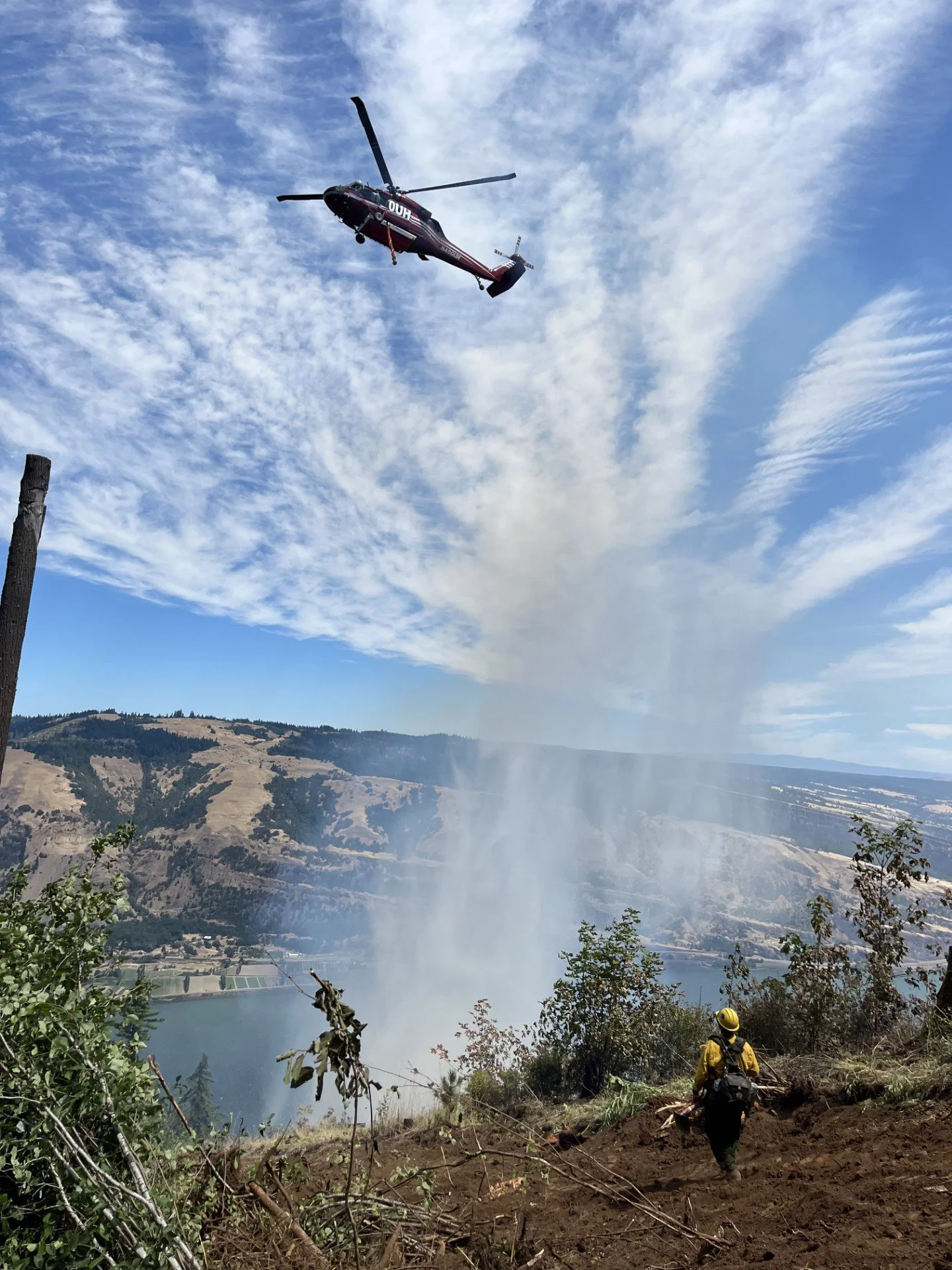
A firefighter watches overhead as a helicopter makes a bucket drop on a ridgeline near Interstate 84 at the Microwave Tower Fire.
From the Oregon Department of Forestry with additions by Tom Peterson:
The Dalles, Ore., July 26, 12 p.m. — Firefighters have contained more than 50 percent of the Microwave Tower Fire burning 5 miles west of Mosier as “significant progress” was made in the last 24 hours.
The fire is estimated to be 760-plus acres burning in draws, drainages, and on ridgetops in brush, timber and grass. 131 personnel are battling the blaze.
Oregon is experiencing its worst fire season since 2020, with nearly 1 million acres burned across the state thus far.
At the Microwave fire, no injuries or structure damage has been reported.
“Firefighters have made significant progress, with most of the southern fireline now contained,” according to this morning’s update from the Oregon Department of Forestry. “Crews will be mopping up this area by extinguishing any remaining hot spots, turning over smoldering debris, and stirring with water.”
Firefighters are using burnout and backburning techniques to eliminate fuels and hold the fire lines.
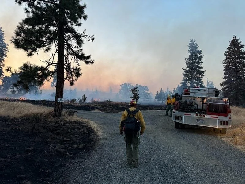
There will be a controlled burn near the northside of the Microwave Tower Fire this morning. Do not be alarmed if you see increased smoke or fire activity. Photo courtesy Wasco County Sheriff
“On the northeast side, last night's successful firing operations in the grass are helping secure fire lines,” the update said. “Due to inaccessible areas and steep terrain, firing operations remain the safest and most effective strategy to remove fuels and prevent the spread of the fire.”
“Today, firefighters will continue these firing operations along the northern edge, utilizing the dozer line, the Columbia River Highway State Trail, and rocky areas, tying it in with the fire that has already reached the trail, securing it all the way from east to west.”
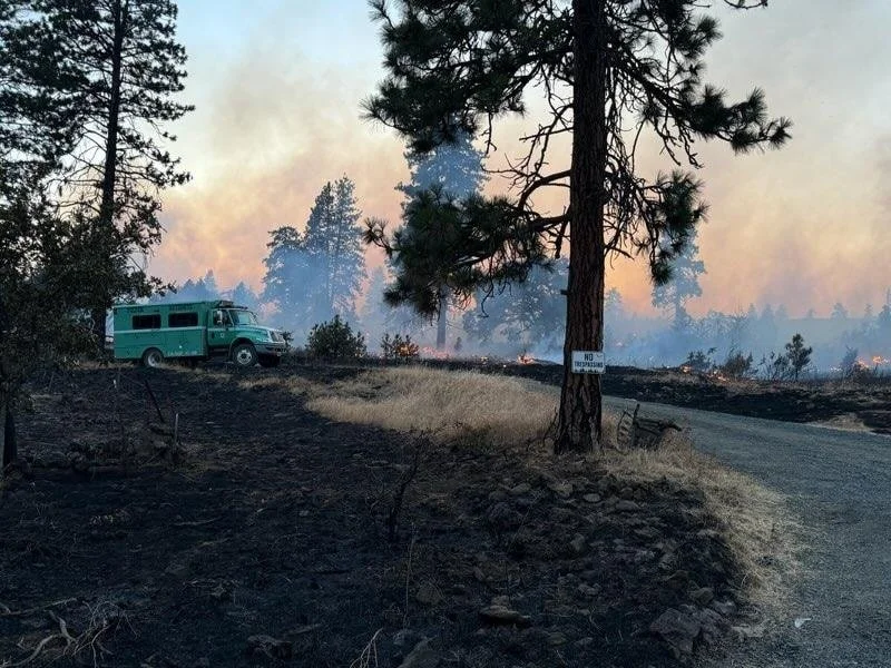
Photo Courtesy Wasco County Sheriff
“Strategic firing operations are strengthening this line, which will increase smoke and may make flames visible. Once completed, this will reduce fuel and lower the risk of fire spread.”
The National Weather Service is predicting 86 degrees in Mosier today with winds building to 6 mph.
Fire managers are predicting low to moderate ffire activity with it creeping, smoldering and backing down slopes toward containment lines. At Mid-day, more smoke is expected in the area from the firing operations.
Location of Fire - click on the image to enlarge it.
Evacuations
Existing Level 3, 2, and 1 evacuations on the east side remain in place.
LEVEL 3 - GO NOW! Evacuate immediately from Hwy 30 south the Proctor Rd., east to Huskey Rd and the border of the City of Mosier and west to the Hood River County line.
LEVEL 2 - GET SET from the City of Mosier and Huskey Rd., south to Wilson Rd., and east to Mosier Creek Rd.
LEVEL 1 - GET READY
- from Mosier Creek Rd., east to Dry Creek Rd., north to the City of Mosier border and south to Osborn Cutoff Rd.
- from the intersection of Hwy 35 and Hwy 30, south to the intersection of Eastside Rd and Paasch Dr., east to Elder Rd. and due north to Historic Columbia River Highway State Trail.
For updated information please follow https://www.facebook.com/WascoCountySheriff. The evacuation preparedness level remains at Level 1 on the west side, please follow https://www.facebook.com/hrcso. The Red Cross center is available at the Hood River Middle School for anyone needing a place to go.
Support Local News
Available to everyone. Funded by readers.