Larch Creek Fire Jumps Highway 197 on grade leading into Tygh Valley
The Larch Creek Fire management team received a briefing this morning, July 11, at Dufur High School, headquarters for The Central Oregon Type 3 Interagency Fire Management Team and the Green Incident Management Team from the Oregon State Fire Marshal.
By Tom Peterson
The Dalles, Ore., July 11, 10 a.m. — Volunteer landowners and firefighters worked through the night to build containment lines on the Larch Creek Fire that is now estimated to have burned more than 10,000 acres near Friend and Tygh Valley south of The Dalles.
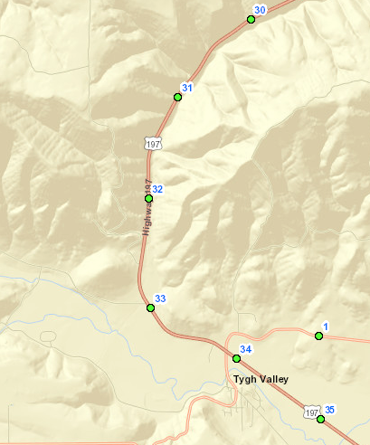
The fire which started on Tuesday, July 9, is now running into its third day burning in rocky and steep terrain in draws and canyons next to Highway 197 in the general area of milepost 30 to Tygh Valley.
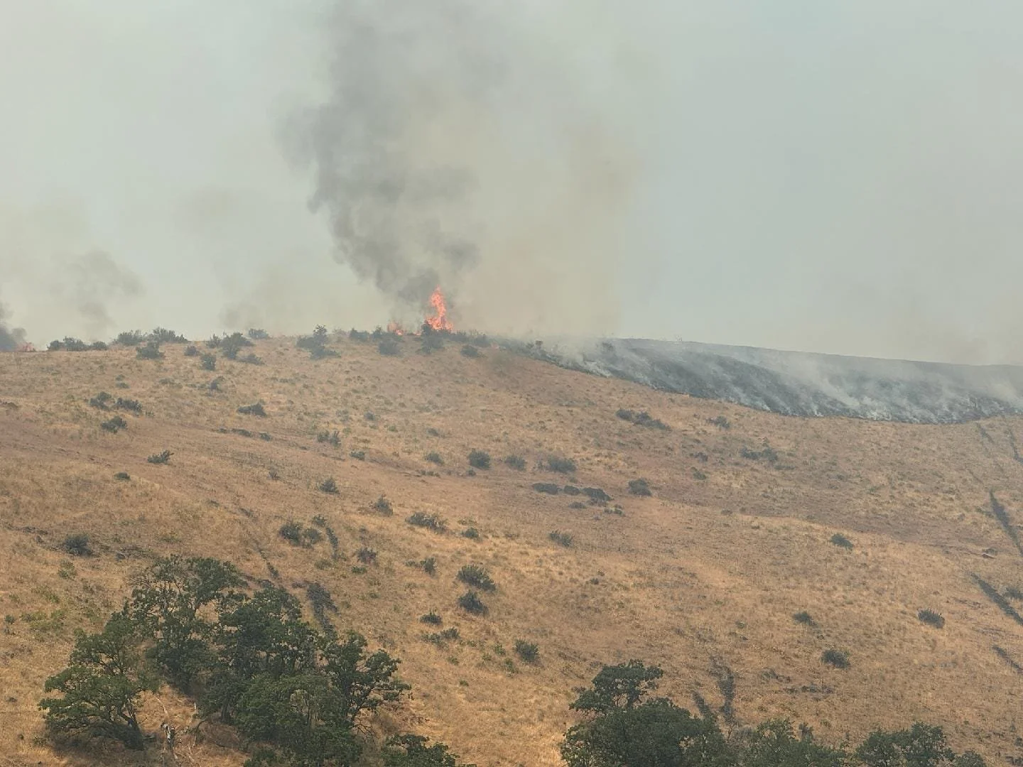
Firefighters had hoped to stop the blaze before it jumped the highway, but big winds yesterday afternoon estimated to be gusting up to 25 mph sent embers over the highway and started fires in the canyon.
The highway is closed to regular traffic currently.
The fire is now running into its third day burning in rocky and steep terrain in draws and canyons next to Highway 197 in the general area of milepost 30 to Tygh Valley.
Red Flag warnings for high heat and tinder-dry conditions spurred Governor Tina Kotek to invoke the Emergency Conflagration Act on Tuesday allowing the the State Fire Marshal to mobilize structural fire resources to protect life and property.
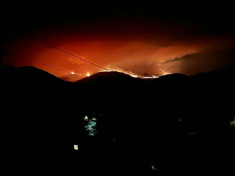
Photo by Mary Beechler - from Tygh Valley captured on Tuesday night, July 9. Posted on Columbia Gorge Wildland Fire and Information Page on Facebook.
“Local folks coming out last night to help fight the fire was a huge huge help,”’ said Andy Dwyer, Oregon Department of Forestry public information officer. “The fire is skirting along Badger Creek area, it kind of bedded down last night and now we hope to capitalize on that and put lines around it and contain it and get measures on it.”
Dwyer said one firefighter so far has been injured thus far, suffering from dehydration on Wednesday.
Firefighters concentrated on saving the Shadybrook community on Wednesday, as they fell back into defensive tactics as heavy winds spread the fire.
“No homes have been lost and there is no confirmation yet on non-residential structures,”’ he said.
As temperatures dropped and humidity increased last night, the fire died back, allowing firefighters to bulldoze additional fireline and backburn, creating a boundary around portions of the fire.
“‘We had lots of progress last night,” Dwyer said.
With temperatures predicted to be in the low 90s and wind at 5 to 13 mph, Dwyer said it was a “good opportunity to get around it.”
In addition to the many local volunteers fighting the fire, Dwyer said 9 hand crews are battling the blaze. Hand crews typically are 18 to 20 people each. So, about 180 firefighters.
Five bulldozers, 23 engines, 4 water tenders, and 2 helicopters with water buckets are also working to bring the fire under control.
Dwyer said there are currently 144 people working within The Central Oregon Type 3 Interagency Fire Management Team and the Green Incident Management Team from the Oregon State Fire Marshal, which is operating from the Dufur High School.
Additional firefighters and equipment are expected today, July 11.
Incident Management Team 2 will be arriving today and transition into unified command with OSFM Green Team this evening, Dwyer said.
“It’s a larger team to manage the fire with more resources and people,” Dwyer said.
From Wasco County Sheriff’s Office:
EVACUATION UPDATES LARCH CREEK FIRE | Thursday, July 11, Noon.
Many evacuations remain in place, however, we have added two new areas to LEVEL 1 - BE READY. Wamic and Pine Hollow remain under an evacuation LEVEL 2 - BE SET. That means there is significant danger in the area and you should be prepared to leave at a moment’s notice. You do not need to panic, however, if you need extra time to evacuate, now is the time to do so.
The Hood River Fairgrounds located at 3020 Wyeast Rd in Hood River, is the evacuation site for people leaving the Wamic and Pine Hollow area. Please take Forest Road 48 west to Highway 35 and into Hood River. See evacuation route map for further details.
LEVEL 3 GO NOW - From Friend Rd, East to Elliott Rd and Hwy 197, South to Badger Creek Rd and Fairgrounds Rd, West to Mc Corkle Grade Rd, city of Tygh Valley. Hwy 197, east to the Deschutes River, north to Hulse Rd and south to Fred Ashley Rd.
LEVEL 2 GET SET- White River, East to the Deschutes River, South to Oak Springs Rd./Juniper Flat Rd. In Pine Hollow & Wamic from Badger Creek Rd/Fairgrounds Rd, South to Rock Creek Dam Rd/Wamic Market Rd, West to Threemile Rd, East to Hwy 197.
LEVEL 1 GET READY -**NEW** From the west border of Van Miller Rd and the north border to the White River. The south border of Old Wapinitia Rd., and from the intersection of Old Wapinitia Rd. to the Deschutes River at a northeast direction. The north border is Oak Spring Rd on the east side of Hwy 197. From the intersection of Kingsley Rd. and Hix Rd. due east to the intersection of Tygh Ridge Rd. and Hwy 197, southeast to where Tygh Ridge Rd. turns north, and Tygh Ridge Rd. to the south.
Wamic Market Rd/Rock Creek Dam Rd., South to the White River, West to Campbell Ln. From Hwy 197, east to the Deschutes River, south to Hulse Rd. From Elliott Rd, East to Kingsley Rd./Dufur Gap Rd., North to Friend Rd. and South to Level 3 border.
Sherman County Fairgrounds is open for evacuation of livestock and pets. Hood River Fairgrounds is also open to displaced animals.
Hwy 197 is back open in both directions.
Support Local News
Available to everyone. Funded by readers.


