
Microwave Tower Fire 79% contained; Tactical burning continues; expect flames, smoke
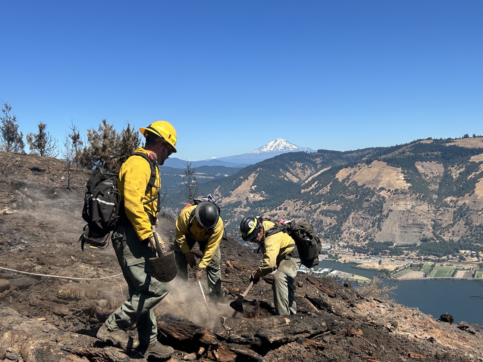
Hand crews dig into hotspots along a ridgeline at the Microwave Tower Fire near Mosier. Photo courtesy the Microwave Tower Fire Facebook Page
From the Microwave Tower Fire page with edits by Tom Peterson:
The Dalles, Ore., Aug. 1, 2024 — Firefighters were able to contain eastern and western lines along Interstate 84 on the 1,311-acre fire burning 5 miles west of Mosier on Wednesday, July 31.
167 personnel with 4 hand crews 9 engines 2 water tenders 2 dozers and 1 skidder are working the blaze which started on July 22 from an undetermined cause.
Highlights
Hot and dry conditions are forecasted for today and residual pockets of vegetation will continue to burn producing visible flame and smoke.
Operations
Today, crews may conduct a tactical burning operation on an interior island of green vegetation. Mosier and the surrounding communities will see a temporary increase in the amount of smoke within the fire area.
Crews will continue to monitor the entire fire’s perimeter to ensure continued security of lines, extinguish hot spots where accessible, and work to increase containment from Old Hwy 30 to I-84.
Fire Behavior and Weather
Record high temperatures are expected and a heat advisory has been issued. Fuels will be dry and interior pockets of unburnt vegetation may produce smoke. Drivers are asked to please use caution on Interstate 84 as firefighters are still working in the area.
Evacuations
Microwave Tower Fire Evacuation Map. Click the image to enlarge it.
LEVEL 2 - GET SET
• from Hwy 30 south to Hood River Rd., east to Rock Creek and Huskey Rd., and west to the Hood River County line.
LEVEL 1 - GET READY
• **DOWNGRADE** from the border of Hood River and Wasco County, south to the Historic Columbia River Highway State Trail, and west to the intersection of Highline Rd. and Old Columbia River Dr., and north to the Columbia River.
• for the City of Mosier from Rock Creek, east to Mosier Creek Rd., south to the intersection of Huskey Rd. and Ponderosa Place and Blanchard Blvd., and west to Rock Creek.
• from the intersection of Hwy 35 and Hwy 30, south to the intersection of Eastside Rd and Paasch Dr., east to Elder Rd. and north to Historic Columbia River Highway State Trail.
For the safety of the public and first responders, the Columbia River Highway State Trail remains closed. Elder Rd. has reopened to local traffic only.Road and Trail Closures:
For public and firefighter safety, there are closures in place for The Historic Columbia River Highway State Trail and for roads in Hood River County. Details of these closures are available on their website.
To stay informed on the most up-to-date road conditions on Interstate 84, visit Tripcheck.
Support Local Unicorn News
Available to everyone. Funded by readers.