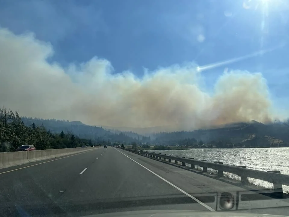
Mosier Fire burning toward I-84; Fast response helps slow blaze; No one reported injured
After 35 mph winds spurred the Microwave Tower Fire on Monday at its outset, calmer weather today looks to aid firefighters on the ground.
By Tom Peterson
The Dalles, Ore., July 23, 10:20 a.m. — It appears no one has been injured or structures lost in the Microwave Tower Fire burning near Mosier Oregon, said Andy Dwyer spokesperson with the Oregon Department of Forestry (ODF).
CCCNews spoke with Dwyer after his initial look at the fire from the ground level this morning, July 23.
He said the fire was currently burning down the rocky cliffs west of Mosier toward Interstate 84.
100 structures are within the fire’s immediate reach, he estimated. However, he said the fire is in the urban interface bringing in engines and firefighters who will work to keep homes from burning.
“We are roughly estimating it at 300 acres,” he said this morning. “We will get an aerial mapping of it later today.”
Multiple local fire districts, ODF, the State Fire Marshall and Columbia River Gorge National Scenic Area U.S. Forest Service are all working to stem the blaze in steep terrain.
Dwyer estimated that there were 30 engines working the fire, while noting aerial attacks with helicopters and Fireboss scooper planes did much on Monday to keep the fire in check.
“Operations last night were shocked on the progress they made,” Dweyer said as winds of 30 to 35 mph pushed the blaze eastward. “From what I was told progress was really successful last night and they hope to carry that on today.”
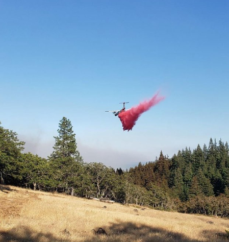
On Monday, an air tanker entered the firefighting mix at 4 p.m., and a task force of fire engines and a dozer from the Larch Creek Fire in south Wasco County were diverted to assist on the Mosier fire, according to ODF.
Air Tanker makes its drop of retardant on Monday, July 22.
Firefighters have their work cut out for them today as the fire is burning in difficult terrain filled with draws and drainages of oak, conifer and grass.
Dwyer said they are expecting winds to average 5 to 10 miles per hour in the low country and 10 to 15 mph on the ridgelines today.
Helicopters and Fireboss Planes will be aiding ground crews today.
“There has been no discussion on the cause yet,” Dwyer said.
The fire has forced the closure of the Columbia Gorge Historic Highway from Mosier to Hood River.
The above fire map shows evacuation levels. Green is level 1; Yellow, Level 2, ; Red, Level 3. Click the image to enlarge it.
Evacuations from Wasco County Sheriff’s Office:
All evacuations will remain in place for the next 24 hours said Wasco County Spokesperson Stephanie Krell this morning. The fire most recently was estimated at 591 acres, and the Oregon Department of Forestry Central Oregon District is investigating the cause.
LEVEL 3 - GO NOW! Evacuate immediately from Hwy 30 south the Proctor Rd., east to Huskey Rd and the border of the City of Mosier and west to the Hood River County line.
LEVEL 2 - GET SET **EXPANDED** from the City of Mosier and Huskey Rd., south to Wilson Rd., and east to Mosier Creek Rd.
LEVEL 1 - GET READY **NEW** from Mosier Creek Rd., east to Dry Creek Rd., north to the City of Mosier border and south to Osborn Cutoff Rd.
A Red Cross shelter for evacuees has been set up at the Hood River Middle School, 1602 May Street, Hood River, OR 97031
Support Local News
Available to everyone. Funded by readers.


