MILLER ROAD FIRE: Wildfire near Maupin and Tygh Valley UPDATED
Welcome to our infomation page on MILLER Road Fire
New updates are added at the top of this article, please scroll down for more info added previously.
A new Facebook page is being used for OSFM Updates, find it here > https://www.facebook.com/OfficialMillerRoadFire
Stay safe, follow evacuation orders, and no drones.
Please check Wasco County Sheriff Page for updated information on evacuations
Wasco County Fire Update 08/05/22 @ 1030 hrs
All properties currently under any type of evacuation advisory on this fire incident have been DOWNGRADED one level at this time.
Operation Video Update Posted 1.40pm 8/4/2022
OSFM Update 8/4/22 - Posted 9.15am
Wasco County, OR – OSFM Task Forces and ODF crews completed their first 24-hour work cycle. Crews worked to create fire containment lines and were supported by air operations. Dozer lines and hand lines were established in the southeast corner of the fire near Ditch Road and Natural Pasture Road. Additional lines were also completed to the north near Old Wapinitia Road.
Firefighters called in aircraft for retardant and water drops to assist with fire suppression and containment.
Late into the afternoon, the fire spotted over the line east of Batty Road and west of Old Wapinitia Road in a field of wheat. Crews and land- owners were able to extinguish it and back burn to create some black.
With great sadness, we are reporting one primary residence was lost to the fire. Fire crews were working to protect the structure at the time. High winds and ember showers were present.
Four Task Forces and one dozer were assigned evening shift. There were no new starts, and the fire did lay down. Today, firefighters will begin the mop-up process on the heal of the fire, along west Miller Road. They will be checking for hot spots and increasing the control line.
Cooler conditions are expected today with temperatures reaching 82-85 degrees. Westerly winds are predicted to be 5-10 mph. Minimal relative humidity recovery overnight. The weekend forecast predicts temperatures increasing to 100 degrees.
We are grateful for the cooperation and support of the Wasco County community, ODF partners, BLM cooperators and the firefighters dedicated to this incident.
An evacuation shelter has been established at the Dufur High School, 802 NE 5th Street.
Wasco County Sheriff’s Office evacuation details can be found by visiting "https://www.facebook.com/WascoCountySheriff"
Support Free Local News
Available for everyone, funded by readers.
Fire Update 8/3/22 - 5.34 PM
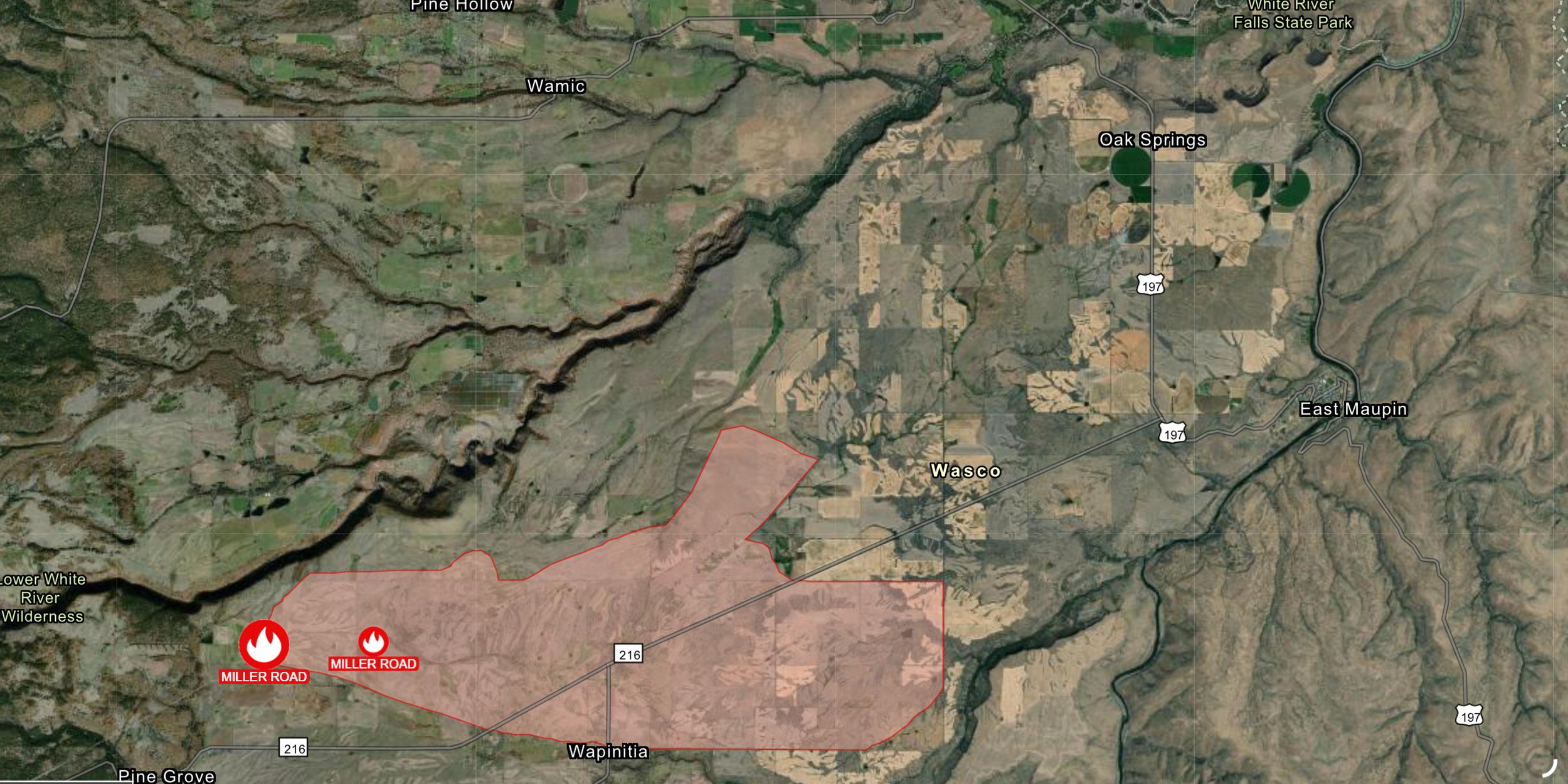
Satellite Imagery and reports from Oregon State Fire Marshall is showing the fire is burning with high winds in heavy dry fuels. The estimated size of the fire is now 10,500+ acres. The crews are currently evaluating snags along the perimeter of the fire and along hwy 216. With teams focused on protecting structures and attacking from the east and south flank. You can see the growth in the image below. To see previous satellite imagery, please scroll down this post.
Update from OSFM - Source
A new facebook page has been dedicated to this information, find it HERE
As always, please check Wasco County Sheriff Page for Updated Evacuation Information
Evacuation Update 9.50AM 8/3/22
Update 4 @ 0950 from Wasco County Sheriff
Miller Rd Fire - Juniper Flat
Level 3
From Victor Rd and Walters Rd North and South side of 216 to Hwy 197 is Now at Level 3 Go.
Level 2 Get Set -
Evacuation notice has been sent for Tygh Valley, all of Tygh Valley Rd, all of Fred Ashley Rd, all of Davidson Grade Rd
East side of 197, all of Oak Spring Rd to 216.
City of Maupin (Both Sides of the Deschutes River)
—
Shelter at Dufur High School.
The Dalles Riders Club is available for Horses.
Fairgrounds is available for Livestock and Horses.
HWY 216 IS NOW OPEN
Satellite Imagery Update
Image taken from CCCNews’ Live Wildfire Satellite Feed - Click here to see live view
Governor Kate Brown Invokes the Emergency Conflagration Act in Response to the Miller Road/Dodge Fire
Source: Twitter @OregonGovBrown - Full Statement HERE
Evacuation Update - 5.40pm
Dodge/Miller Fire Evacuation update
Level 3 - GO NOW
From Victor Rd and Walters Rd North and South side of 216 to Hwy 197 is Now at Level 3 Go.
LEVEL 2 - GET SET
Tygh Valley
Tygh Valley Rd, Tygh Valley , all of Fred Ashley Rd, all of Davidson Grade Rd
East side of 197, all of Oak Spring Rd to 216.
Maupin North and west of the Deschutes River.
Shelter is being opened at Dufur High School.
The Dalles Riders Club and Fairgrounds are available for horses..
216 is closed from Pine Grove to Hwy 197
Live Stream - Update 5.34pm
Evacuation Update - 5.24pm 8/2/2022
Maupin is now at Level 2 Get Set
Level 2 for Maupin North and west of the Deschutes River.
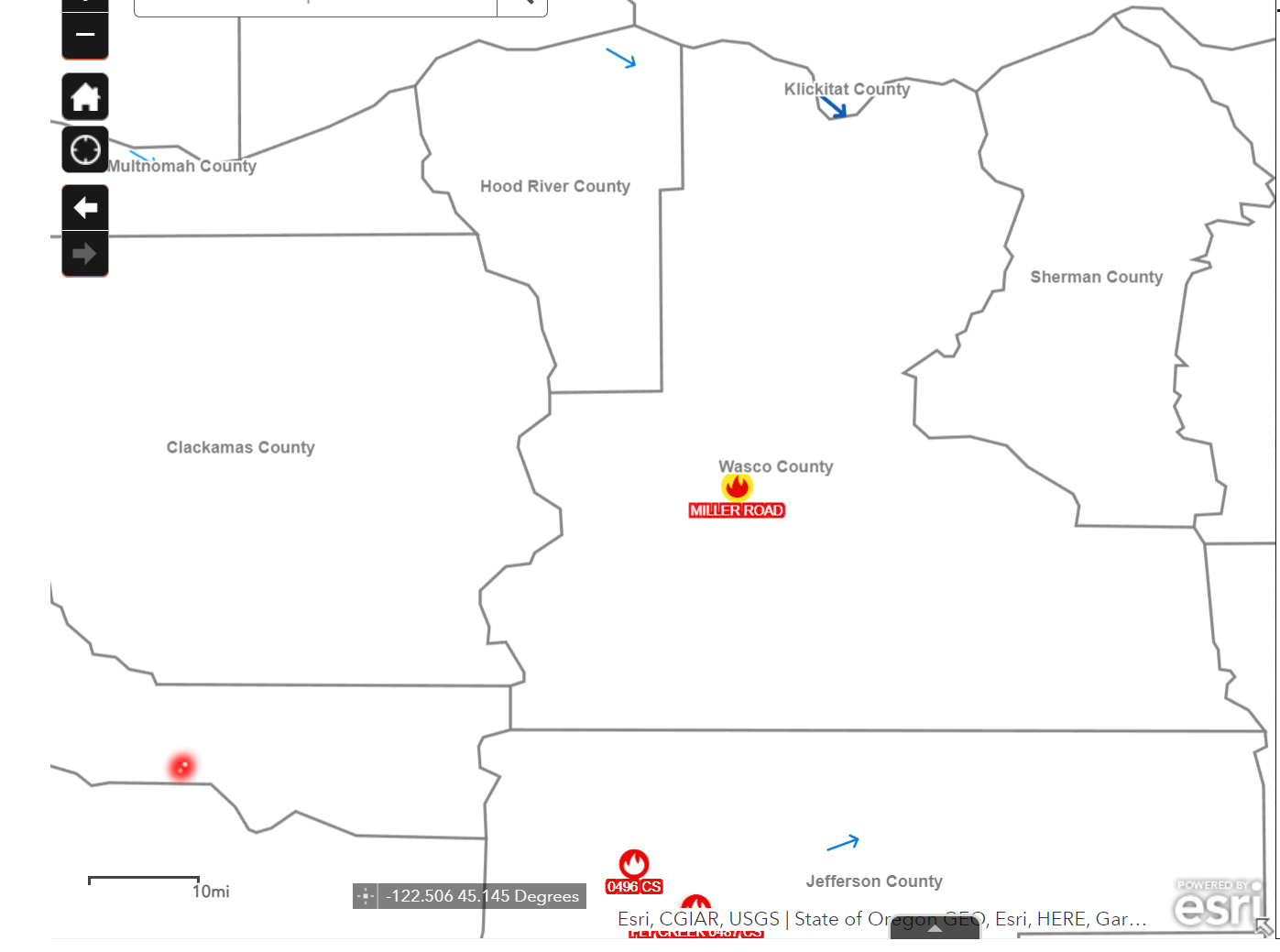
A Wildfire, initially names MILLER FRE now renamed to DODGE FIRE has ignited today August 2nd east of Maupin and Tygh Valley. Updates will be posted at the top of the article as we get new information
Initlal reports place the fire’s source near Juniper Flats / Pine Grove.
Fire Stats so far according to the Facebook group admins on Columbia Gorge Wildland & Fire Information Page
LOCATION: Hwy 216 and Victor Road (near old Miller Road and Endersby Roads) - approaching Victor Road.
GPS: 45 8.724, -121 19.260
SIZE: 1,000+ acres - Governor has declared a conflagration
% contained: TBD
PERSONNEL / EQUIPMENT:
9403
9420
9421
Bat 2
E-321
E-421
E-601
E-9461
E-9466
Tanker 105
Tanker 107
Tanker 132
Tanker 914
Bravo 061
RESPONDING AGENCIES:
Juniper Flats Fire
Wamic Fire
Tygh Valley Fire
Maupin Fire
Dufur Fire
ODF
BLM
USFS
WEATHER: 93F Humidity 18% Winds sustained at 20 mph gusting to 26 mph blowing due east. Smoke is hampering visibility on Hwy 97.
FIRE GROWTH POTENTIAL: HIGH/EXTREME - 94% possibility of ignition
Evacuations
Please check Wasco County Sheriff Page for updated information on evacuations. At the time of this reporting (4.40 pm - 8/2/22) the evacuations are as follows.
Level 3 From Victor Rd and Walters Rd North and South side of 216 to Hwy 197 is Now at Level 3 Go.
Level 2 Evacuation notice has been sent for Tygh Valley
Level 2 Get Set, all of Tygh Valley Rd, Tygh Valley , all of Fred Ashley Rd, all of Davidson Grade Rd is now at
Level 2 Get Set for East side of 197, all of Oak Spring Rd to 216.
Level 1 for Maupin North and west of the Deschutes River.
Shelter is being opened at Dufur High School
FIRE PLANES DIPPING IN PINE HOLLOW RESERVOIR or Timothy Lake - please stay clear.
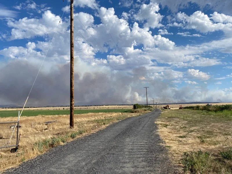
Smoke seen above Tygh Valley, Photo by Tom Peterson on the ground.
View at 5.22pm from Wamic Market Road looking west, Photo by Tom Peterson


