
Grasshopper Fire tops 10,700 acres as crews hold key lines; 8-Mile Fire reaches 35% containment
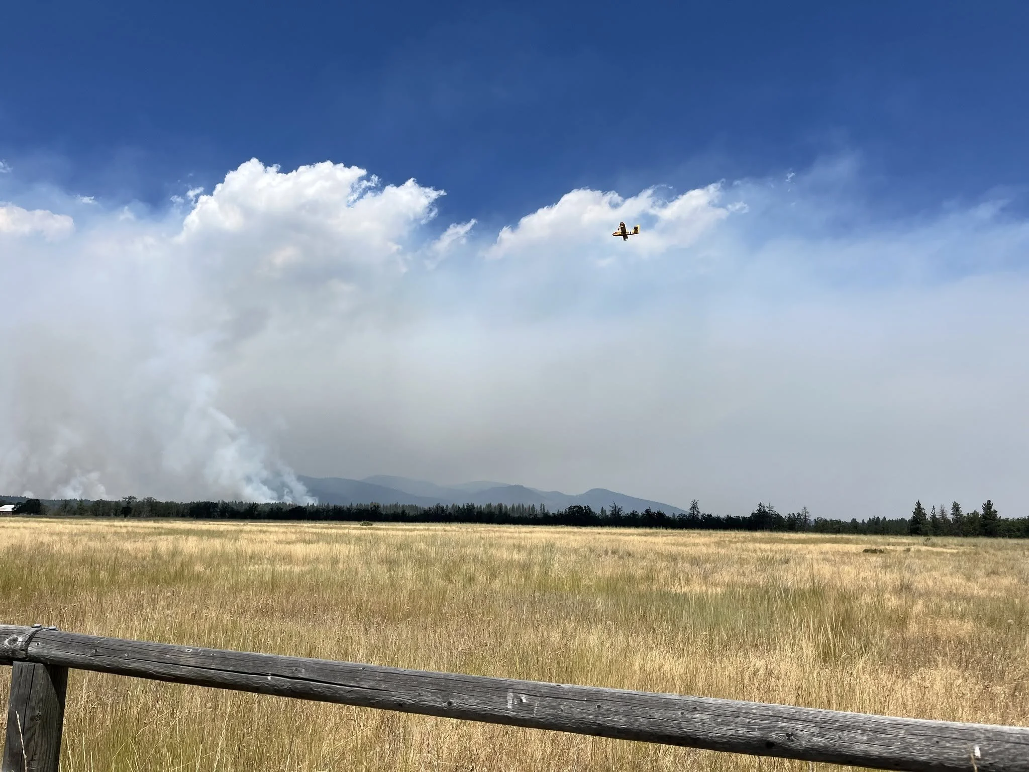
Photo Courtesy the Grasshopper Fire Facebook Page.
The Dalles, Ore., July 27, 2026 — Firefighters made significant progress Monday on two major wildfires burning in and near Wasco County, holding critical containment lines on the Grasshopper Fire while increasing containment on the smaller Eightmile Fire west of Dufur.
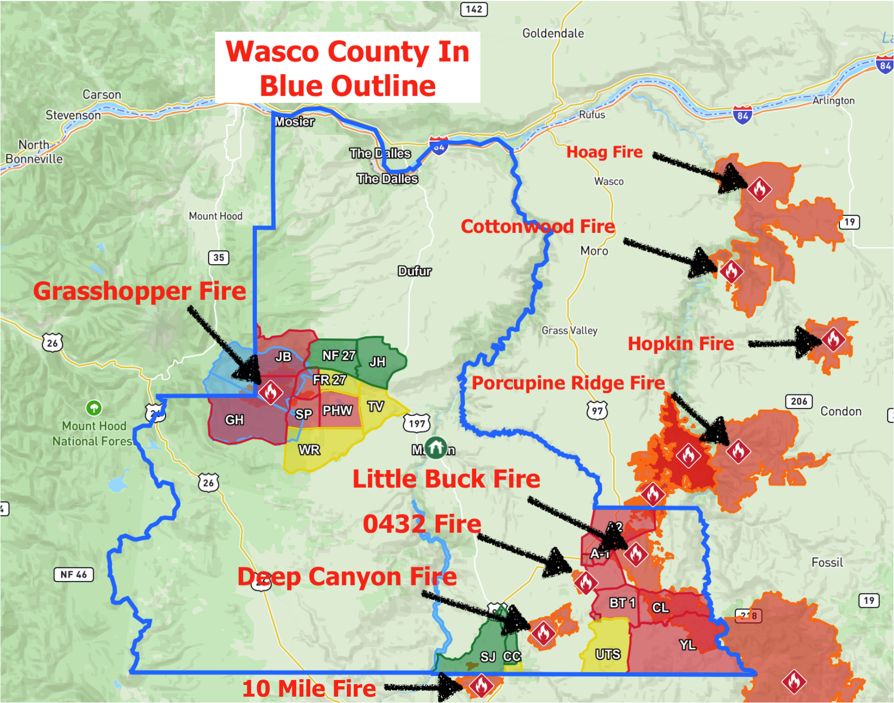
The Grasshopper Fire, burning in the Mount Hood National Forest near Grasshopper Point, is now estimated at 10,742 acres after an overnight infrared flight provided a more accurate mapping of the fire perimeter.
Fire managers said aggressive air support and ground operations helped prevent the fire from advancing toward homes Sunday despite extreme fire behavior. Sixteen aircraft, including four Very Large Air Tankers, four Large Air Tankers, four helicopters and four fixed-wing scoopers, conducted repeated water and retardant drops throughout the day.
Firefighters also constructed about four miles of fire line along Highland Ditch between the fire's edge and Pine Hollow, while Oregon State Fire Marshal task forces continued around-the-clock structure protection for Sportsmans Park and Pine Hollow. Officials said no new spot fires were discovered overnight after crews completed a burnout operation and continued mop-up efforts.
Approximately 300 personnel, 14 engines, seven pieces of heavy equipment and two Oregon State Fire Marshal task forces remain assigned to the fire.
Level 3 "Go Now" evacuation orders remain in effect for Sportsmans Park, Pine Hollow and portions of the Mount Hood National Forest. Level 2 evacuations remain in place for Smock Road, White River Crossing, Badger Creek, Shadybrook Road and Tygh Valley, while Level 1 evacuations extend from Forest Road 27 to Friend Road and portions of Highway 197. A shelter remains open at Maupin High School.
Meanwhile, the Eightmile Fire, located along Eightmile Road about five miles west of Dufur, remained at 532 acres after firefighters stopped its forward spread the night it started on July 24.
According to Oregon Department of Forestry officials, the fire reached 35% containment as of July 26. Crews continue strengthening containment lines and mopping up hot spots, with containment expected to increase as firefighters work farther into the burned area.
Several other fires continue burning across the region.
The 10 Mile Fire near the Jefferson County border has grown to 4,834 acres, while the adjacent lightning-caused 586 Fire is estimated at 191 acres. Officials have lowered some evacuation levels in the area, with portions of Highway 97 reduced from Level 3 to Level 2 and additional areas downgraded from Level 2 to Level 1. South Junction Road has reopened, although Bureau of Land Management closures remain in effect along portions of the Deschutes River corridor.
The Little Buck Fire, part of the Hay Creek Complex, is estimated at approximately 334,723 acres. Level 3 evacuations remain in effect for Shaniko, Antelope, Clarno and portions of Highway 97, with Level 2 evacuations continuing between Upper Tubs Road and Cold Camp Road.
The Deep Canyon Fire remains at 8,089 acres, and all remaining Level 1 evacuation notices have been lifted.
Fire officials reminded residents that evacuation levels are based on fire behavior, weather, terrain and the time needed for safe evacuations, rather than distance from a fire alone. Residents are encouraged to monitor official updates and evacuation maps as conditions continue to change.
Support Local News!
Available for Everyone; Funded by Readers.