
Williams Mine Fire doubles over weekend to 10,000 plus acres

To protect the community while suppressing the Williams Mine Fire, an incident command post has been set up in Trout Lake. We understand the inconvenience and thank you for your patience as engines, trucks and slow moving heavy machinery navigate to and from the fire perimeter. - Williams Mine Fire page
By Tom Peterson
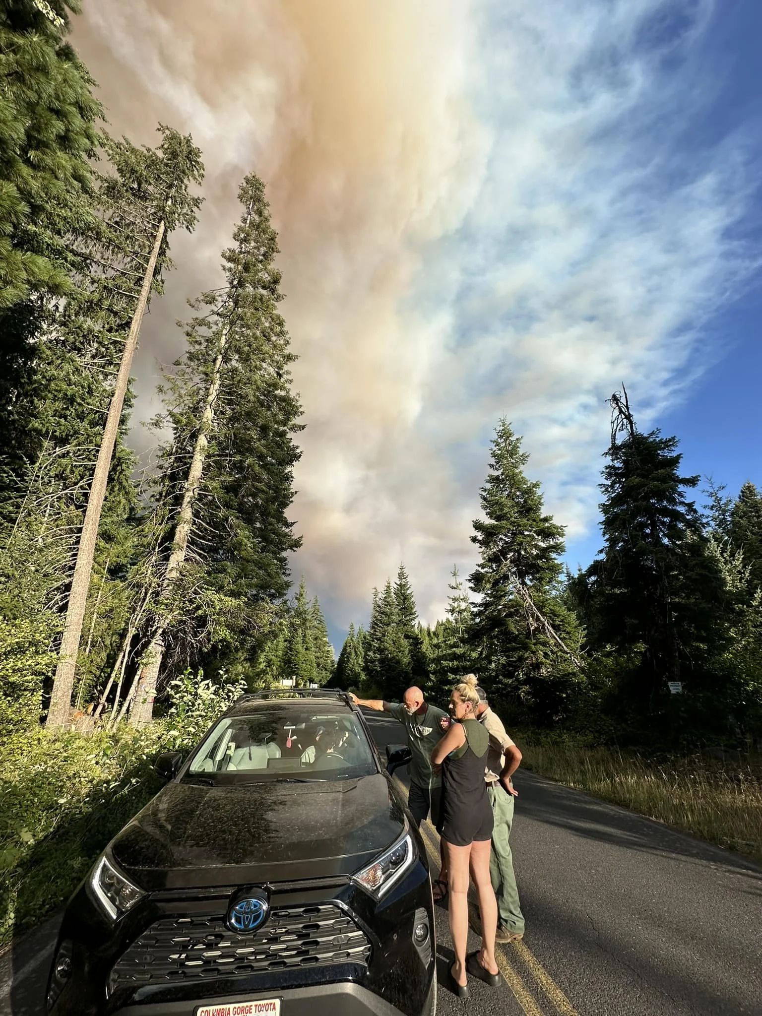
The Dalles, Ore., Aug. 12, 2024, 10 a.m. — The Williams Mine Fire burning 3.5 miles northwest of Trout Lake, Wash., more than doubled in size over the weekend to an estimated 10,000-plus acre fire which is burning in thick forest in the Mt. Adam’s Ranger district.
Firefighters may get an assist from the weather this week as cooler temperatures and higher humidity are predicted.
186 personnel are fighting the blaze, including 4 hand crews, 9 engines, and 8 dozers.
“A new fire was detected yesterday approximately one-half mile west of the 23 road. Resources were available to actively engage this new start, and aviation resources were utilized to suppress the new ignition, according to a U.S. Forest Service press release. “Ground firefighting resources are constructing perimeter control lines to achieve containment.”
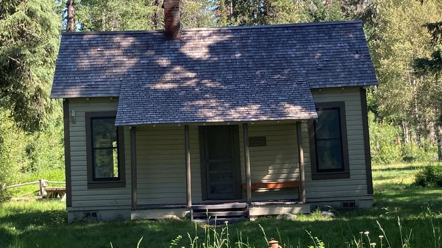
Structure Protection/ Before - Photo by Tom Jones
“The structure protection group had a successful day - Aug. 11 - as operational resources arrived and built upon previous days’ fire mitigation efforts around private infrastructure within level 3 evacuation zones near Trout Lake, WA.”
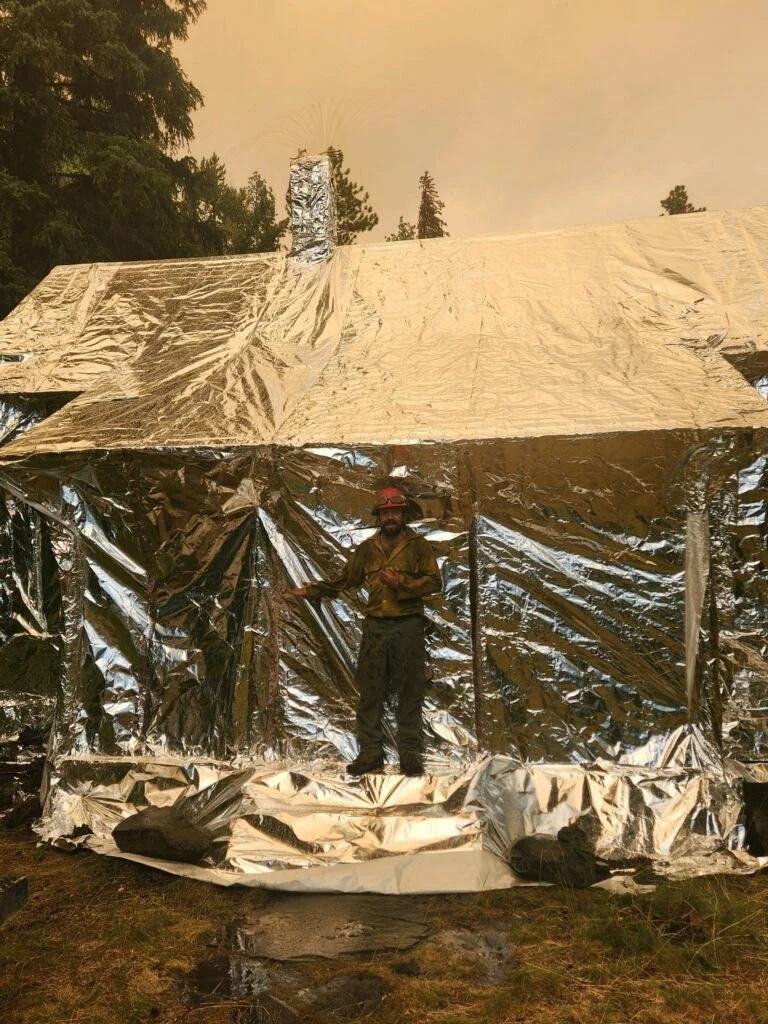
Structure Protection/ After - Photo by Tom Jones
“The Northwest Incident Team continues to work with local government officials prioritizing firefighting efforts within the communities directly adjacent to the fire.”
“On the northwest side of the fire perimeter, crews continue to scout and identify potential containment lines to tie fire spread into natural features. Dozers are being used to connect geographical features along the 8031 road as crews look for opportunities to limit fire spread from progressing to the south.”
“To the east on the 060 road, crews are suppressing spot fires that were established yesterday around Snipes Mountain. Due to rugged and steep terrain, spot fires to the southeast of the fire perimeter are difficult to access, and a heavy snag component also is present in this area from previous fire scars. Firefighters are developing strategies to gain anchor points in this area utilizing indirect line construction control features. Fire managers anticipate easterly progression to continue due to the strong westerly winds being forecasted.”
Forecasters for the National Weather Service are predicting a cooler week for the Trout Lake area with high temperatures in the 70s.
Today, the high is expected to be 75 with winds ranging from 6 to 13 mph. However, stronger winds with gusts exceeding 25 mph are expected today, but relative humidities will rise at elevations below 4,000 feet providing moisture to the environment.
“Fog may also accumulate in lower elevations on Tuesday, and Wednesday morning, Aug 13 and 14. This weather change also has the potential for thunderstorms arriving Thursday, which may provide measurable precipitation which could aid in slowing fire progression on the Williams Mine Fire,” fire managers stated.
Williams Mine Fire Evacuation and fire map - U.S. Forest Service / Click the image to enlarge it.
CLOSURES / EVACUATIONS
Effective immediately, Washington DNR managed lands near Trout Lake and Glenwood will be closed to entry due to the Williams Mine fire. For more information, please see http://www.dnr.wa.gov/ahtanum.
The Confederated Tribes and Bands of the Yakama Nation, Tract D Recreation Area is closed, please see Yakama Tract D Road Closure for more information. Level 2 & 3 evacuations are in effect for the community of Trout Lake. An evacuation center is located at 1455 NW Bruin County Road, White Salmon, Washington. Evacuations are coordinated through the Klickitat County Sheriff’s Office and the Skamania County Sheriff’s Office. The FS-23 and FS-25 roads are closed, see the Williams Mine Area and Road Closure for more details. The Pacific Crest Trail (PCT) is closed from the PCT's intersection with FS 23 to Potato Hill. The current Forest closure spans the entire Mt. Adams Wilderness.
Support Local News
Available to everyone. Funded by readers.