
Thunderstorms possible in Gorge; Hail if we know, but there’s a chance
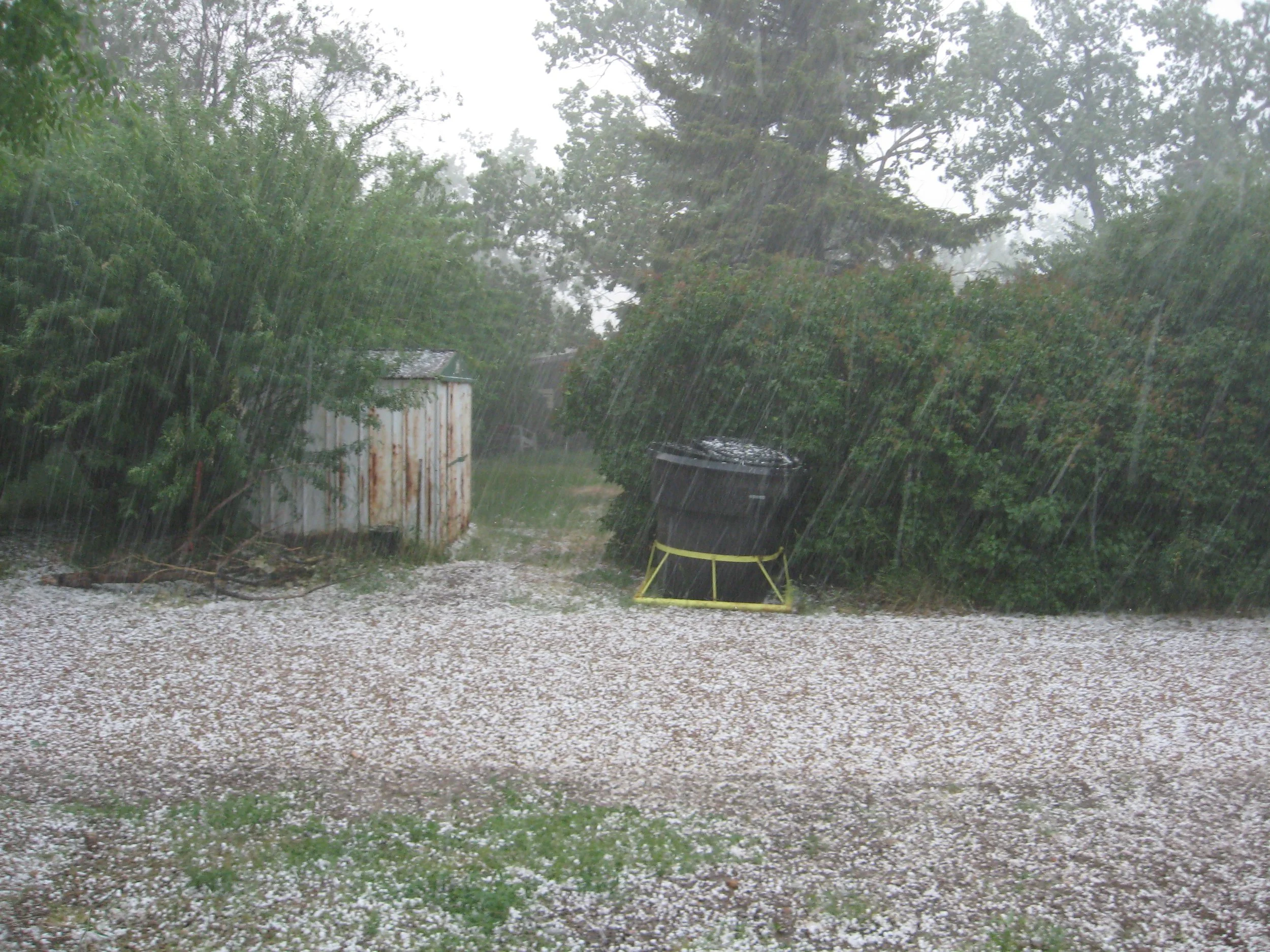
The Dalles, Ore., May 28, 2026 — Residents in The Dalles, Hood River and across the Columbia River Gorge may see thunderstorms develop Thursday afternoon and evening as a weather system moves across the Pacific Northwest, though forecasters say the greatest risk for stronger storms remains east of the Cascades.
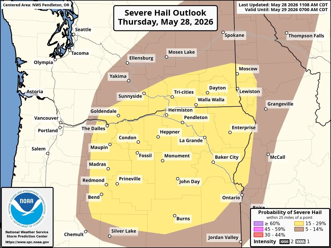
Oh, Hail, no, but maybe Hail yes. Probability of hail is 15 to 29 percent in the yellow zone above.
The National Weather Service office in Portland said isolated to scattered thunderstorms are possible across portions of Northwest Oregon and Southwest Washington, including the Gorge. The agency has placed much of the Gorge under a Marginal Risk, or Level 1 out of 5, for severe thunderstorms, while parts of Hood River County and areas farther east fall under a Slight Risk, or Level 2 out of 5.
Those risk levels can sound more dramatic than they are.
A Level 1 risk means a few storms could become strong enough to produce localized impacts, but widespread severe weather is not expected. A Level 2 risk means scattered stronger storms are somewhat more likely, though it still does not indicate a major outbreak or a high-confidence severe weather event.
For The Dalles and Hood River, the most likely impacts would be lightning, brief downpours, small hail and occasional wind gusts. The National Weather Service said any stronger storm that develops could produce wind gusts approaching 60 mph and hail up to about quarter size, though those outcomes are expected to remain isolated rather than widespread.
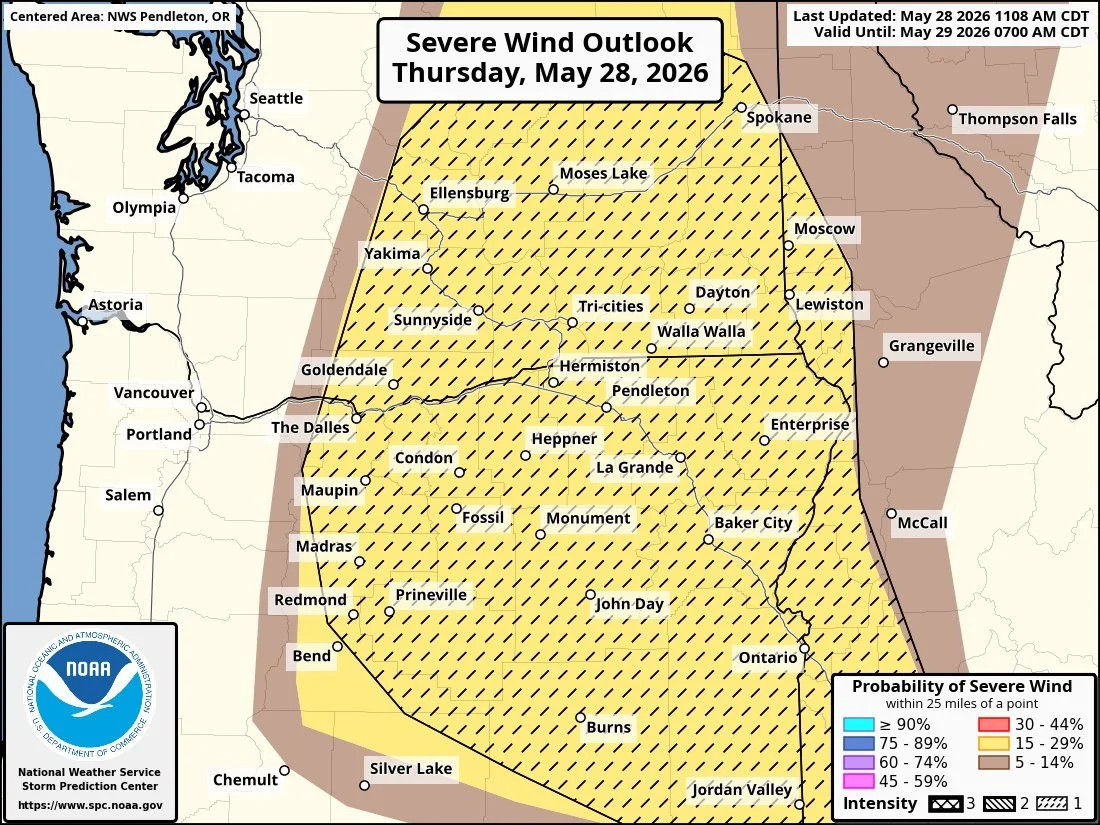
Probabilty of severe wind seen here in yellow is 14 to 29 percent.
Forecasters say the atmosphere will become more favorable for thunderstorm development during the afternoon and evening, especially along the Cascades, the Upper Hood River Valley and areas east of the mountains. The primary window for storm activity is expected from late afternoon through the evening hours.
East of the Cascades, conditions are more supportive of stronger thunderstorms. Parts of Central and Eastern Oregon, along with portions of Eastern Washington, could see storms capable of stronger wind gusts, larger hail and more frequent lightning. The Storm Prediction Center has identified portions of those regions within the Level 2 risk area.
While lightning and wind are the main concerns, forecasters are also watching for brief periods of heavy rainfall beneath stronger storm cells. However, the overall forecast does not point toward a widespread flooding event.
For much of Western Oregon west of the Gorge, the risk drops considerably. The National Weather Service notes there is only a lower, though not zero, chance that storms drifting off the Cascades could reach lower-elevation communities farther west, including portions of the Willamette Valley.
By Friday, cooler temperatures and scattered showers are expected to replace Thursday's warmer and more unstable conditions. Forecast models then show a return to drier weather over the weekend, followed by another warming trend early next week.
For Gorge residents, the forecast is less about severe weather and more about staying aware of changing conditions. A passing thunderstorm, brief heavy rain or gusty winds are all possible Thursday afternoon and evening, but forecasters emphasize that the more significant storm potential remains east of the Cascades.