
Whiskey Creek Fire near Cascade Locks bumps to 850 acres; Dozers digging in
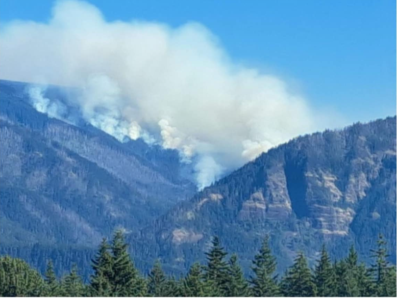
Photo courtesy Mt. Adams Area Emergency & Info page
From U.S. Forest Service:
The Dalles, Ore, July 26, 3 p.m.— Crews made progress on preparing containment lines to the south of the active fire area yesterday. Heavy equipment was brought in to assist with clearing roads and creating fuel breaks reopening an Eagle Creek Fire contingency line. Conditions were also favorable for an infra-red flight allowing for better mapping of the area and a more accurate number of acres burned.
244 personnel, 5 hand crews, 5 water tenders, 2 dozers, and 2 helicopters are working the blaze now estimated at more than 850 acres. The fire is burning approximately 6 miles southeast of Cascade Locks in the Mark O. Hatfield Wilderness.
No injuries have been reported.
Crews continue to prepare containment lines, clearing roads and trails, to the southeast along the Rainy-Wahtum Trail #409 from Rainy Lake to Wahtum Lake and continuing to the Pacific Crest Trail (PCT) approximately one mile to the 2017 Eagle Creek Fire burn area. A temporary reroute of the PCT to the Eagle Creek Trail is expected. To the east of the fire, crews continue to strengthen a containment line along the Gorton Creek Trail #408 and identify potential contingency lines further east. Crew will continue to do fuels reduction work and tie in an indirect line along the edge of the wilderness area.
Fire Behavior & Weather
The fire is burning within the Mark O. Hatfield Wilderness and moving steadily along the eastern edge up Woolly Horn Ridge and west towards Waucoma Ridge. Moderate upslope growth is expected to continue around the fire’s edges with the potential for wind to push to the south. Smoke will continue to be visible, especially in the afternoon, as fire consumes denser pockets of vegetation and dead-and-down fuels. Decreasing humidity and light and variable winds will allow for warmer and drier conditions over the area today. This may increase fire activity and smoke, especially in the afternoon.
Whiskey Creek Fire locater map - click the image to enlarge it.
Evacuations, Road and Trail Closures, and Restrictions
The Mt. Hood National Forest and the Columbia River Gorge National Scenic Area have issued a joint emergency closure for the fire area. Closure information can be found on the Mt. Hood National Forest website Alerts & Closures page at: Whisky Creek Fire Closures in Mark O. Hatfield Wilderness.

Support Local News
Available to everyone. Funded by readers.